Carlson CAD Solutions Year End Specials!
Carlson CADnet with Maintenance

New to Carlson? Learn More Here
+
The Carlson Software modules for land development professionals provide very competitive alternatives to Autodesk‘s Civil 3D, Land Desktop (retired), Civil Design (retired), Raster Design (retired), Paydirt (retired), Quest Construction and Agtek software programs.

Carlson’s desktop software must be installed with a CAD platform such as IntelliCAD, AutoCAD or embedded AutoCAD (OEM). Carlson Software includes a perpetual license of IntelliCAD with their “For CAD” modules but also allows users to install the program on top of your own separately purchased license of a full AutoCAD-based program such as AutoCAD, Map or Civil 3D.

Carlson Survey and Carlson Takeoff are the only 2 programs that can be purchased with an embedded AutoCAD (OEM) license.

ALL Carlson desktop products work natively in the latest DWG format. This means that you create DWG files, you open DWG files and you save DWG files – there is no need to import, export or convert to others using a different CAD-based program.

Your purchase of Carlson includes a perpetual license of the Carlson program and either IntelliCAD or embedded AutoCAD (OEM).

Carlson Software can be purchased as individual modules or by bundling 2 or more products at a discounted price so you only pay for what you need!

Carlson Civil Suite includes the Survey, Civil, Hydrology and GIS modules and compares to Autodesk Civil 3D.

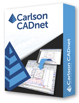
Carlson CADnet is a single module that’s functionality is comparable to Autodesk Raster Design.

You can also use a Select Suite to build your own bundle of a Pick 2, Pick 3, Pick 4, Pick 5 or Pick 6 choosing from Survey, Civil, Hydrology, GIS, CADnet and Point Cloud Basic.

Carlson Takeoff Suite and Takeoff with embedded AutoCAD (OEM) is comparable to Paydirt (retired), Quest Construction and Agtek software programs.

All Carlson desktop software products provide a wide range of conversion and import and export functions for other file formats such as Civil 3d, LandXML, Topcon and Trimble.

For Carlson products that run with IntellliCAD and/or your separately purchased license of AutoCAD, Carlson offers users an Annual Maintenance program that keeps the software up to date. The purchase of Maintenance is optional and pricing is calculated at 10% of the retail price of the product per year.

Carlson Software offers free technical support from their main office to all Carlson Software users regardless of customer or license status.

Although users may find it difficult to install older Carlson desktop software on newer machines due to limitations of newer Windows operating systems, Carlson continues offering support for those versions.

More About Carlson CADnet
+
Carlson CADnet empowers users to seamlessly transform non-CAD documents like PDFs and raster images into CAD format, with tools for cleaning up text and linework.

CADnet offers commands for digitizing contours, spot elevations, areas, profiles, and cross sections, while recent updates enhance its capabilities with features like exporting drawing entities to 3D PDF files and importing/exporting BIM models, providing a comprehensive solution for CAD conversion and integration.


Carlson CADnet allows users to import raster images and PDF files and, if needed, even to merge multiple images into one file that can be digitized or otherwise converted by CAD software using a variety of raster-to-vector routines. CADnet also gives you many tools to help clean up text and linework generated from raster images.

Carlson CADnet provides a selection of commands for digitizing (from paper, or on screen) contours, spot elevations, areas, profiles and cross sections.

Recent updates to CADnet gives you the ability to export drawing entities to 3D PDF files, import Sketchup files and import and export BIM models (doors, windows, walls, roofs, etc.) and bring them into CAD as CAD software entities; plus, CADnet includes a routine to export surfaces into BIM.

Relevant FAQs from That CAD Girl
+
Delivery, Downloads and 30 Day Trials
+
Delivery & Downloads

All Carlson Software purchases will be fulfilled electronically by a download link that will be emailed to you (along with your new serial number) within two business days of your order being processed. The download link and serial number can be used to install and register your software immediately.

For delivery to addresses within the United States, we can also ship you a flash drive via UPS Ground for an additional charge. Please note that the physical shipment DOES NOT include manuals.

Your box shipment will arrive approximately 14 business days after your order has been processed. Be aware that software purchases outside the United States will be fulfilled by download only. If you pay the extra charge for the physical shipment we will only provide a download link and will then refund the shipping charge.

30 Day Trials

Click here to request a 30 day trial serial number

Need more pricing options?
+
Need pricing for upgrades, maintenance renewals or for orders of 4 or more licenses?

Click here to send us a message or click here to Request a Custom Proposal to see what we can do!
Terms and Conditions for All Sales
+


Carlson CAD Solutions Year End Specials!
Carlson Construction with Maintenance

New to Carlson? Learn More Here
+
The Carlson Software modules for land development professionals provide very competitive alternatives to Autodesk‘s Civil 3D, Land Desktop (retired), Civil Design (retired), Raster Design (retired), Paydirt (retired), Quest Construction and Agtek software programs.

Carlson’s desktop software must be installed with a CAD platform such as IntelliCAD, AutoCAD or embedded AutoCAD (OEM). Carlson Software includes a perpetual license of IntelliCAD with their “For CAD” modules but also allows users to install the program on top of your own separately purchased license of a full AutoCAD-based program such as AutoCAD, Map or Civil 3D.

Carlson Survey and Carlson Takeoff are the only 2 programs that can be purchased with an embedded AutoCAD (OEM) license.

ALL Carlson desktop products work natively in the latest DWG format. This means that you create DWG files, you open DWG files and you save DWG files – there is no need to import, export or convert to others using a different CAD-based program.

Your purchase of Carlson includes a perpetual license of the Carlson program and either IntelliCAD or embedded AutoCAD (OEM).

Carlson Software can be purchased as individual modules or by bundling 2 or more products at a discounted price so you only pay for what you need!

Carlson Civil Suite includes the Survey, Civil, Hydrology and GIS modules and compares to Autodesk Civil 3D.

Carlson CADnet is a single module that’s functionality is comparable to Autodesk Raster Design.

You can also use a Select Suite to build your own bundle of a Pick 2, Pick 3, Pick 4, Pick 5 or Pick 6 choosing from Survey, Civil, Hydrology, GIS, CADnet and Point Cloud Basic.

Carlson Takeoff Suite and Takeoff with embedded AutoCAD (OEM) is comparable to Paydirt (retired), Quest Construction and Agtek software programs.

All Carlson desktop software products provide a wide range of conversion and import and export functions for other file formats such as Civil 3d, LandXML, Topcon and Trimble.

For Carlson products that run with IntellliCAD and/or your separately purchased license of AutoCAD, Carlson offers users an Annual Maintenance program that keeps the software up to date. The purchase of Maintenance is optional and pricing is calculated at 10% of the retail price of the product per year.

Carlson Software offers free technical support from their main office to all Carlson Software users regardless of customer or license status.

Although users may find it difficult to install older Carlson desktop software on newer machines due to limitations of newer Windows operating systems, Carlson continues offering support for those versions.

More About Carlson Construction
+
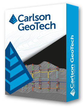
Carlson Construction stands as the cornerstone of Carlson’s suite of takeoff and surface modeling tools tailored for contractors.

Within Carlson Construction, users can effortlessly generate and tailor comprehensive volume reports, encompassing cut/fill volumes, subgrade volumes, strata volumes, topsoil removal/replacement, and over-excavate volumes. Employing 3D triangulation models ensures the utmost accuracy in volume calculations, whether for the entire site or specific “Areas of Interest.”

The software offers a variety of visualization tools to verify quantities and convey findings effectively, including 3D Drive Simulation, 3D Drawing Viewer, 3D Surface Viewer, Quick Profile, Cut/Fill Color Map, and Cut/Fill Contours with daylight lines. Moreover, it supports shrink/swell factors and facilitates seamless export to PDF or Excel.

Subgrades are seamlessly defined through layers and linework in the drawing, with detailed material volume, area, length, and count reporting options available in standard reports, PDFs, or Excel sheets.

Vertical adjustments to the design surface are effortlessly managed through subgrade depths. The software automatically navigates complex subgrade areas and offers hatching functionalities for swift quality control checks.

From cross-sections for volumes to crafting machine control models with super elevations, Carlson Construction excels in road-related tasks. It encompasses features like Import/Create/Draw Centerlines, vertical profiles, design templates, and cross-sections to streamline road construction processes.

With the robust RoadNET command, users can dynamically construct roads and model intersections, while tools for calculating end areas volumes and conducting mass haul analysis further enhance project preparation capabilities.

For seamless transition to fieldwork, the software offers commands like Draw-Locate Points, Create Points from Entities, Divide Along Entity, Triangulation File Utilities, alongside support for Topcon, Trimble, and Leica Machine Control Surface Export, ensuring accurate stakeout or machine control implementation.

Relevant FAQs from That CAD Girl
+
Delivery, Downloads and 30 Day Trials
+
Delivery & Downloads

All Carlson Software purchases will be fulfilled electronically by a download link that will be emailed to you (along with your new serial number) within two business days of your order being processed. The download link and serial number can be used to install and register your software immediately.

For delivery to addresses within the United States, we can also ship you a flash drive via UPS Ground for an additional charge. Please note that the physical shipment DOES NOT include manuals.

Your box shipment will arrive approximately 14 business days after your order has been processed. Be aware that software purchases outside the United States will be fulfilled by download only. If you pay the extra charge for the physical shipment we will only provide a download link and will then refund the shipping charge.

30 Day Trials

Click here to request a 30 day trial serial number

Need more pricing options?
+
Need pricing for upgrades, maintenance renewals or for orders of 4 or more licenses?

Click here to send us a message or click here to Request a Custom Proposal to see what we can do!
Terms and Conditions for All Sales
+


Carlson CAD Solutions Year End Specials!
Carlson GeoTech with Maintenance

New to Carlson? Learn More Here
+
The Carlson Software modules for land development professionals provide very competitive alternatives to Autodesk‘s Civil 3D, Land Desktop (retired), Civil Design (retired), Raster Design (retired), Paydirt (retired), Quest Construction and Agtek software programs.

Carlson’s desktop software must be installed with a CAD platform such as IntelliCAD, AutoCAD or embedded AutoCAD (OEM). Carlson Software includes a perpetual license of IntelliCAD with their “For CAD” modules but also allows users to install the program on top of your own separately purchased license of a full AutoCAD-based program such as AutoCAD, Map or Civil 3D.

Carlson Survey and Carlson Takeoff are the only 2 programs that can be purchased with an embedded AutoCAD (OEM) license.

ALL Carlson desktop products work natively in the latest DWG format. This means that you create DWG files, you open DWG files and you save DWG files – there is no need to import, export or convert to others using a different CAD-based program.

Your purchase of Carlson includes a perpetual license of the Carlson program and either IntelliCAD or embedded AutoCAD (OEM).

Carlson Software can be purchased as individual modules or by bundling 2 or more products at a discounted price so you only pay for what you need!

Carlson Civil Suite includes the Survey, Civil, Hydrology and GIS modules and compares to Autodesk Civil 3D.

Carlson CADnet is a single module that’s functionality is comparable to Autodesk Raster Design.

You can also use a Select Suite to build your own bundle of a Pick 2, Pick 3, Pick 4, Pick 5 or Pick 6 choosing from Survey, Civil, Hydrology, GIS, CADnet and Point Cloud Basic.

Carlson Takeoff Suite and Takeoff with embedded AutoCAD (OEM) is comparable to Paydirt (retired), Quest Construction and Agtek software programs.

All Carlson desktop software products provide a wide range of conversion and import and export functions for other file formats such as Civil 3d, LandXML, Topcon and Trimble.

For Carlson products that run with IntellliCAD and/or your separately purchased license of AutoCAD, Carlson offers users an Annual Maintenance program that keeps the software up to date. The purchase of Maintenance is optional and pricing is calculated at 10% of the retail price of the product per year.

Carlson Software offers free technical support from their main office to all Carlson Software users regardless of customer or license status.

Although users may find it difficult to install older Carlson desktop software on newer machines due to limitations of newer Windows operating systems, Carlson continues offering support for those versions.

More About Carlson GeoTech
+
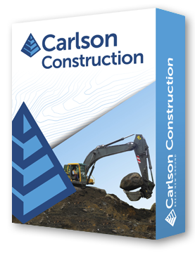
Carlson GeoTech is a module that allows the user to enter data from borehole data and model the resulting strata surfaces.

Strata surfaces derived from borehole data offer valuable insights for calculating Strata Cut, Topsoil Removal, or Over-Excavation of materials.

Once these surfaces are generated, they seamlessly integrate into standard features like Calculate Total Volumes, Quick Profile, Surface Inspector, and Cut/Fill Labels. Advanced Settings empower users to select various modeling methods, ensuring the creation of the most precise Strata surface possible.

Relevant FAQs from That CAD Girl
+
Delivery, Downloads and 30 Day Trials
+
Delivery & Downloads

All Carlson Software purchases will be fulfilled electronically by a download link that will be emailed to you (along with your new serial number) within two business days of your order being processed. The download link and serial number can be used to install and register your software immediately.

For delivery to addresses within the United States, we can also ship you a flash drive via UPS Ground for an additional charge. Please note that the physical shipment DOES NOT include manuals.

Your box shipment will arrive approximately 14 business days after your order has been processed. Be aware that software purchases outside the United States will be fulfilled by download only. If you pay the extra charge for the physical shipment we will only provide a download link and will then refund the shipping charge.

30 Day Trials

Click here to request a 30 day trial serial number

Need more pricing options?
+
Need pricing for upgrades, maintenance renewals or for orders of 4 or more licenses?

Click here to send us a message or click here to Request a Custom Proposal to see what we can do!
Terms and Conditions for All Sales
+


Carlson CAD Solutions Year End Specials!
Carlson Select Suite – Pick 6
with Maintenance

New to Carlson? Learn More Here
+
The Carlson Software modules for land development professionals provide very competitive alternatives to Autodesk‘s Civil 3D, Land Desktop (retired), Civil Design (retired), Raster Design (retired), Paydirt (retired), Quest Construction and Agtek software programs.

Carlson’s desktop software must be installed with a CAD platform such as IntelliCAD, AutoCAD or embedded AutoCAD (OEM). Carlson Software includes a perpetual license of IntelliCAD with their “For CAD” modules but also allows users to install the program on top of your own separately purchased license of a full AutoCAD-based program such as AutoCAD, Map or Civil 3D.

Carlson Survey and Carlson Takeoff are the only 2 programs that can be purchased with an embedded AutoCAD (OEM) license.

ALL Carlson desktop products work natively in the latest DWG format. This means that you create DWG files, you open DWG files and you save DWG files – there is no need to import, export or convert to others using a different CAD-based program.

Your purchase of Carlson includes a perpetual license of the Carlson program and either IntelliCAD or embedded AutoCAD (OEM).

Carlson Software can be purchased as individual modules or by bundling 2 or more products at a discounted price so you only pay for what you need!

Carlson Civil Suite includes the Survey, Civil, Hydrology and GIS modules and compares to Autodesk Civil 3D.

Carlson CADnet is a single module that’s functionality is comparable to Autodesk Raster Design.

You can also use a Select Suite to build your own bundle of a Pick 2, Pick 3, Pick 4, Pick 5 or Pick 6 choosing from Survey, Civil, Hydrology, GIS, CADnet and Point Cloud Basic.

Carlson Takeoff Suite and Takeoff with embedded AutoCAD (OEM) is comparable to Paydirt (retired), Quest Construction and Agtek software programs.

All Carlson desktop software products provide a wide range of conversion and import and export functions for other file formats such as Civil 3d, LandXML, Topcon and Trimble.

For Carlson products that run with IntellliCAD and/or your separately purchased license of AutoCAD, Carlson offers users an Annual Maintenance program that keeps the software up to date. The purchase of Maintenance is optional and pricing is calculated at 10% of the retail price of the product per year.

Carlson Software offers free technical support from their main office to all Carlson Software users regardless of customer or license status.

Although users may find it difficult to install older Carlson desktop software on newer machines due to limitations of newer Windows operating systems, Carlson continues offering support for those versions.

More About the Programs in the Select Suite
+
Carlson Survey encompasses a wide array of features comparable to survey and GIS components found in various software programs, including retired ones like DCA/Softdesk/Land Desktop and Eagle Point.

Survey offers comprehensive desktop drafting, calculation, and mapping capabilities essential for land surveyors, alongside seamless integration with field data collection software like SurvPC and SurvCE.
Learn More About Carlson Survey


Carlson Civil extends beyond the capabilities of the CAD platform it operates on, offering dynamic design tools tailored for site, subdivision, and roadway engineers.

Comparable to industry-standard engineering design software, Carlson Civil provides features for layer-based quantity takeoffs, 3D modeling, and construction estimating, including specialized commands like SiteNet for streamlined volume and material quantity calculations.
Learn More About Carlson Civil


Carlson Hydrology offers engineers and hydrologists a user-friendly hydrologic and hydraulic solution seamlessly integrated into CAD environments, allowing for easy navigation and utilization of common elements like polylines and text.

With its comprehensive suite of features, Carlson Hydrology streamlines site drainage and runoff analysis, storm drain system design and drafting, and precise pond design and sizing, providing a robust toolset for water management projects.
Learn More About Carlson Hydrology


Carlson GIS offers a comprehensive set of tools for managing Geographic Information Systems, supporting both importing from Esri Shapefiles and creating GIS entities within DWG files. GIS gives users the ability to insert and convert geo-referenced images from sources like Esri and Google Earth, and includes features for data capture, labeling, import/export of SHP files, and polygon topology analysis.

Carlson calls this program “An awesome GIS “Swiss Army Knife” for the surveyor or engineer.”
Learn More About Carlson GIS


Carlson CADnet empowers users to seamlessly transform non-CAD documents like PDFs and raster images into CAD format, with tools for cleaning up text and linework. It offers commands for digitizing contours, spot elevations, areas, profiles, and cross sections, while recent updates enhance its capabilities with features like exporting drawing entities to 3D PDF files and importing/exporting BIM models, providing a comprehensive solution for CAD conversion and integration.
Learn More About Carlson CADnet


Carlson Point Cloud Basic allows users to efficiently register scans to local coordinates, automate field-to-finish processing of linework and symbols, and generate contours, profiles, sections, and breaklines directly from point cloud data. This innovative software seamlessly integrates with Carlson Survey, Carlson Civil, and Carlson Mining programs, empowering users to handle extensive datasets of up to 1 billion points and produce CAD deliverables effortlessly within the familiar Carlson environment.
Learn More about Point Cloud Basic

Relevant FAQs from That CAD Girl
+
Delivery, Downloads and 30 Day Trials
+
Delivery & Downloads

All Carlson Software purchases will be fulfilled electronically by a download link that will be emailed to you (along with your new serial number) within two business days of your order being processed. The download link and serial number can be used to install and register your software immediately.

For delivery to addresses within the United States, we can also ship you a flash drive via UPS Ground for an additional charge. Please note that the physical shipment DOES NOT include manuals.

Your box shipment will arrive approximately 14 business days after your order has been processed. Be aware that software purchases outside the United States will be fulfilled by download only. If you pay the extra charge for the physical shipment we will only provide a download link and will then refund the shipping charge.

30 Day Trials

Click here to request a 30 day trial serial number

Need more pricing options?
+
Need pricing for upgrades, maintenance renewals or for orders of 4 or more licenses?

Click here to send us a message or click here to Request a Custom Proposal to see what we can do!
Terms and Conditions for All Sales
+


Carlson CAD Solutions Year End Specials!
Carlson Takeoff Suite with IntelliCAD
with YOUR AutoCAD with Maintenance

New to Carlson? Learn More Here
+
The Carlson Software modules for land development professionals provide very competitive alternatives to Autodesk‘s Civil 3D, Land Desktop (retired), Civil Design (retired), Raster Design (retired), Paydirt (retired), Quest Construction and Agtek software programs.

Carlson’s desktop software must be installed with a CAD platform such as IntelliCAD, AutoCAD or embedded AutoCAD (OEM). Carlson Software includes a perpetual license of IntelliCAD with their “For CAD” modules but also allows users to install the program on top of your own separately purchased license of a full AutoCAD-based program such as AutoCAD, Map or Civil 3D.

Carlson Survey and Carlson Takeoff are the only 2 programs that can be purchased with an embedded AutoCAD (OEM) license.

ALL Carlson desktop products work natively in the latest DWG format. This means that you create DWG files, you open DWG files and you save DWG files – there is no need to import, export or convert to others using a different CAD-based program.

Your purchase of Carlson includes a perpetual license of the Carlson program and either IntelliCAD or embedded AutoCAD (OEM).

Carlson Software can be purchased as individual modules or by bundling 2 or more products at a discounted price so you only pay for what you need!

Carlson Civil Suite includes the Survey, Civil, Hydrology and GIS modules and compares to Autodesk Civil 3D.

Carlson CADnet is a single module that’s functionality is comparable to Autodesk Raster Design.

You can also use a Select Suite to build your own bundle of a Pick 2, Pick 3, Pick 4, Pick 5 or Pick 6 choosing from Survey, Civil, Hydrology, GIS, CADnet and Point Cloud Basic.

Carlson Takeoff Suite and Takeoff with embedded AutoCAD (OEM) is comparable to Paydirt (retired), Quest Construction and Agtek software programs.

All Carlson desktop software products provide a wide range of conversion and import and export functions for other file formats such as Civil 3d, LandXML, Topcon and Trimble.

For Carlson products that run with IntellliCAD and/or your separately purchased license of AutoCAD, Carlson offers users an Annual Maintenance program that keeps the software up to date. The purchase of Maintenance is optional and pricing is calculated at 10% of the retail price of the product per year.

Carlson Software offers free technical support from their main office to all Carlson Software users regardless of customer or license status.

Although users may find it difficult to install older Carlson desktop software on newer machines due to limitations of newer Windows operating systems, Carlson continues offering support for those versions.

More About the Programs in Takeoff Suite
+
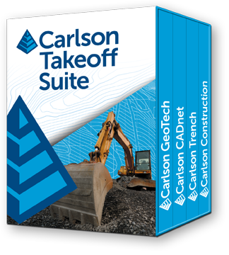
Carlson Construction serves as the cornerstone of Carlson’s suite for contractors, offering comprehensive volume reporting and visualization tools to ensure accurate project management.

With features like 3D Drive Simulation and seamless integration with CAD platforms, Carlson Construction streamlines road construction and facilitates seamless transition to fieldwork, ensuring precise stakeout and machine control implementation.

Learn More About Carlson Construction


Carlson CADnet empowers users to seamlessly transform non-CAD documents like PDFs and raster images into CAD format, with tools for cleaning up text and linework. It offers commands for digitizing contours, spot elevations, areas, profiles, and cross sections, while recent updates enhance its capabilities with features like exporting drawing entities to 3D PDF files and importing/exporting BIM models, providing a comprehensive solution for CAD conversion and integration.

Learn More About Carlson CADnet


Carlson GeoTech is a module that allows the user to enter data from borehole data and model the resulting strata surfaces.
Strata surfaces derived from borehole data offer valuable insights for calculating Strata Cut, Topsoil Removal, or Over-Excavation of materials.

Once these surfaces are generated, they seamlessly integrate into standard features like Calculate Total Volumes, Quick Profile, Surface Inspector, and Cut/Fill Labels. Advanced Settings empower users to select various modeling methods, ensuring the creation of the most precise Strata surface possible.

Learn More About Carlson GeoTech


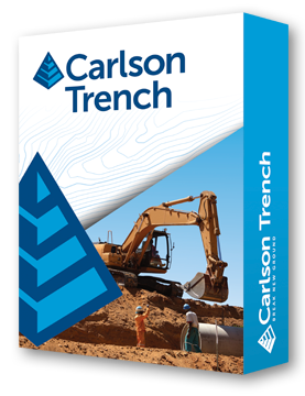
Carlson Trench makes it easy to input data for pipes, trenches, and manholes.

Trench reports can be customized to include comprehensive details such as cut volumes, backfill quantities, linear footage of pipes categorized by size and material and additional information.

Trench reports can be validated using pipe profiles, viewing pipes in 3D view and plotting a depth zone color map.

Learn More About Carlson Trench

Relevant FAQs from That CAD Girl
+
Delivery, Downloads and 30 Day Trials
+
Delivery & Downloads

All Carlson Software purchases will be fulfilled electronically by a download link that will be emailed to you (along with your new serial number) within two business days of your order being processed. The download link and serial number can be used to install and register your software immediately.

For delivery to addresses within the United States, we can also ship you a flash drive via UPS Ground for an additional charge. Please note that the physical shipment DOES NOT include manuals.

Your box shipment will arrive approximately 14 business days after your order has been processed. Be aware that software purchases outside the United States will be fulfilled by download only. If you pay the extra charge for the physical shipment we will only provide a download link and will then refund the shipping charge.

30 Day Trials

Click here to request a 30 day trial serial number

Need more pricing options?
+
Need pricing for upgrades, maintenance renewals or for orders of 4 or more licenses?

Click here to send us a message or click here to Request a Custom Proposal to see what we can do!
Terms and Conditions for All Sales
+


Carlson CAD Solutions Year End Specials!
Carlson Trench with Maintenance

New to Carlson? Learn More Here
+
The Carlson Software modules for land development professionals provide very competitive alternatives to Autodesk‘s Civil 3D, Land Desktop (retired), Civil Design (retired), Raster Design (retired), Paydirt (retired), Quest Construction and Agtek software programs.

Carlson’s desktop software must be installed with a CAD platform such as IntelliCAD, AutoCAD or embedded AutoCAD (OEM). Carlson Software includes a perpetual license of IntelliCAD with their “For CAD” modules but also allows users to install the program on top of your own separately purchased license of a full AutoCAD-based program such as AutoCAD, Map or Civil 3D.

Carlson Survey and Carlson Takeoff are the only 2 programs that can be purchased with an embedded AutoCAD (OEM) license.

ALL Carlson desktop products work natively in the latest DWG format. This means that you create DWG files, you open DWG files and you save DWG files – there is no need to import, export or convert to others using a different CAD-based program.

Your purchase of Carlson includes a perpetual license of the Carlson program and either IntelliCAD or embedded AutoCAD (OEM).

Carlson Software can be purchased as individual modules or by bundling 2 or more products at a discounted price so you only pay for what you need!

Carlson Civil Suite includes the Survey, Civil, Hydrology and GIS modules and compares to Autodesk Civil 3D.

Carlson CADnet is a single module that’s functionality is comparable to Autodesk Raster Design.

You can also use a Select Suite to build your own bundle of a Pick 2, Pick 3, Pick 4, Pick 5 or Pick 6 choosing from Survey, Civil, Hydrology, GIS, CADnet and Point Cloud Basic.

Carlson Takeoff Suite and Takeoff with embedded AutoCAD (OEM) is comparable to Paydirt (retired), Quest Construction and Agtek software programs.

All Carlson desktop software products provide a wide range of conversion and import and export functions for other file formats such as Civil 3d, LandXML, Topcon and Trimble.

For Carlson products that run with IntellliCAD and/or your separately purchased license of AutoCAD, Carlson offers users an Annual Maintenance program that keeps the software up to date. The purchase of Maintenance is optional and pricing is calculated at 10% of the retail price of the product per year.

Carlson Software offers free technical support from their main office to all Carlson Software users regardless of customer or license status.

Although users may find it difficult to install older Carlson desktop software on newer machines due to limitations of newer Windows operating systems, Carlson continues offering support for those versions.

More About Carlson Trench
+
Carlson Trench makes it easy to input data for pipes, trenches, and manholes.

Trench reports can be customized to include comprehensive details such as cut volumes, backfill quantities, linear footage of pipes categorized by size and material and additional information.

Trench reports can be validated using pipe profiles, viewing pipes in 3D view and plotting a depth zone color map.

Relevant FAQs from That CAD Girl
+
Delivery, Downloads and 30 Day Trials
+
Delivery & Downloads

All Carlson Software purchases will be fulfilled electronically by a download link that will be emailed to you (along with your new serial number) within two business days of your order being processed. The download link and serial number can be used to install and register your software immediately.

For delivery to addresses within the United States, we can also ship you a flash drive via UPS Ground for an additional charge. Please note that the physical shipment DOES NOT include manuals.

Your box shipment will arrive approximately 14 business days after your order has been processed. Be aware that software purchases outside the United States will be fulfilled by download only. If you pay the extra charge for the physical shipment we will only provide a download link and will then refund the shipping charge.

30 Day Trials

Click here to request a 30 day trial serial number

Need more pricing options?
+
Need pricing for upgrades, maintenance renewals or for orders of 4 or more licenses?

Click here to send us a message or click here to Request a Custom Proposal to see what we can do!
Terms and Conditions for All Sales
+


Carlson CAD Solutions Year End Specials!
Carlson Select Suite – Pick 3 with Maintenance

New to Carlson? Learn More Here
+
The Carlson Software modules for land development professionals provide very competitive alternatives to Autodesk‘s Civil 3D, Land Desktop (retired), Civil Design (retired), Raster Design (retired), Paydirt (retired), Quest Construction and Agtek software programs.

Carlson’s desktop software must be installed with a CAD platform such as IntelliCAD, AutoCAD or embedded AutoCAD (OEM). Carlson Software includes a perpetual license of IntelliCAD with their “For CAD” modules but also allows users to install the program on top of your own separately purchased license of a full AutoCAD-based program such as AutoCAD, Map or Civil 3D.

Carlson Survey and Carlson Takeoff are the only 2 programs that can be purchased with an embedded AutoCAD (OEM) license.

ALL Carlson desktop products work natively in the latest DWG format. This means that you create DWG files, you open DWG files and you save DWG files – there is no need to import, export or convert to others using a different CAD-based program.

Your purchase of Carlson includes a perpetual license of the Carlson program and either IntelliCAD or embedded AutoCAD (OEM).

Carlson Software can be purchased as individual modules or by bundling 2 or more products at a discounted price so you only pay for what you need!

Carlson Civil Suite includes the Survey, Civil, Hydrology and GIS modules and compares to Autodesk Civil 3D.

Carlson CADnet is a single module that’s functionality is comparable to Autodesk Raster Design.

You can also use a Select Suite to build your own bundle of a Pick 2, Pick 3, Pick 4, Pick 5 or Pick 6 choosing from Survey, Civil, Hydrology, GIS, CADnet and Point Cloud Basic.

Carlson Takeoff Suite and Takeoff with embedded AutoCAD (OEM) is comparable to Paydirt (retired), Quest Construction and Agtek software programs.

All Carlson desktop software products provide a wide range of conversion and import and export functions for other file formats such as Civil 3d, LandXML, Topcon and Trimble.

For Carlson products that run with IntellliCAD and/or your separately purchased license of AutoCAD, Carlson offers users an Annual Maintenance program that keeps the software up to date. The purchase of Maintenance is optional and pricing is calculated at 10% of the retail price of the product per year.

Carlson Software offers free technical support from their main office to all Carlson Software users regardless of customer or license status.

Although users may find it difficult to install older Carlson desktop software on newer machines due to limitations of newer Windows operating systems, Carlson continues offering support for those versions.

More About the Programs in the Select Suite
+
Carlson Survey encompasses a wide array of features comparable to survey and GIS components found in various software programs, including retired ones like DCA/Softdesk/Land Desktop and Eagle Point.

Survey offers comprehensive desktop drafting, calculation, and mapping capabilities essential for land surveyors, alongside seamless integration with field data collection software like SurvPC and SurvCE.
Learn More About Carlson Survey


Carlson Civil extends beyond the capabilities of the CAD platform it operates on, offering dynamic design tools tailored for site, subdivision, and roadway engineers.

Comparable to industry-standard engineering design software, Carlson Civil provides features for layer-based quantity takeoffs, 3D modeling, and construction estimating, including specialized commands like SiteNet for streamlined volume and material quantity calculations.
Learn More About Carlson Civil


Carlson Hydrology offers engineers and hydrologists a user-friendly hydrologic and hydraulic solution seamlessly integrated into CAD environments, allowing for easy navigation and utilization of common elements like polylines and text.

With its comprehensive suite of features, Carlson Hydrology streamlines site drainage and runoff analysis, storm drain system design and drafting, and precise pond design and sizing, providing a robust toolset for water management projects.
Learn More About Carlson Hydrology


Carlson GIS offers a comprehensive set of tools for managing Geographic Information Systems, supporting both importing from Esri Shapefiles and creating GIS entities within DWG files. GIS gives users the ability to insert and convert geo-referenced images from sources like Esri and Google Earth, and includes features for data capture, labeling, import/export of SHP files, and polygon topology analysis.

Carlson calls this program “An awesome GIS “Swiss Army Knife” for the surveyor or engineer.”
Learn More About Carlson GIS


Carlson CADnet empowers users to seamlessly transform non-CAD documents like PDFs and raster images into CAD format, with tools for cleaning up text and linework. It offers commands for digitizing contours, spot elevations, areas, profiles, and cross sections, while recent updates enhance its capabilities with features like exporting drawing entities to 3D PDF files and importing/exporting BIM models, providing a comprehensive solution for CAD conversion and integration.
Learn More About Carlson CADnet


Carlson Point Cloud Basic allows users to efficiently register scans to local coordinates, automate field-to-finish processing of linework and symbols, and generate contours, profiles, sections, and breaklines directly from point cloud data. This innovative software seamlessly integrates with Carlson Survey, Carlson Civil, and Carlson Mining programs, empowering users to handle extensive datasets of up to 1 billion points and produce CAD deliverables effortlessly within the familiar Carlson environment.
Learn More about Point Cloud Basic

Relevant FAQs from That CAD Girl
+
Delivery, Downloads and 30 Day Trials
+
Delivery & Downloads

All Carlson Software purchases will be fulfilled electronically by a download link that will be emailed to you (along with your new serial number) within two business days of your order being processed. The download link and serial number can be used to install and register your software immediately.

For delivery to addresses within the United States, we can also ship you a flash drive via UPS Ground for an additional charge. Please note that the physical shipment DOES NOT include manuals.

Your box shipment will arrive approximately 14 business days after your order has been processed. Be aware that software purchases outside the United States will be fulfilled by download only. If you pay the extra charge for the physical shipment we will only provide a download link and will then refund the shipping charge.

30 Day Trials

Click here to request a 30 day trial serial number

Need more pricing options?
+
Need pricing for upgrades, maintenance renewals or for orders of 4 or more licenses?

Click here to send us a message or click here to Request a Custom Proposal to see what we can do!

Terms and Conditions for All Sales
+


Carlson CAD Solutions Year End Specials!
Carlson Select Suite – Pick 5 with Maintenance

New to Carlson? Learn More Here
+
The Carlson Software modules for land development professionals provide very competitive alternatives to Autodesk‘s Civil 3D, Land Desktop (retired), Civil Design (retired), Raster Design (retired), Paydirt (retired), Quest Construction and Agtek software programs.

Carlson’s desktop software must be installed with a CAD platform such as IntelliCAD, AutoCAD or embedded AutoCAD (OEM). Carlson Software includes a perpetual license of IntelliCAD with their “For CAD” modules but also allows users to install the program on top of your own separately purchased license of a full AutoCAD-based program such as AutoCAD, Map or Civil 3D.

Carlson Survey and Carlson Takeoff are the only 2 programs that can be purchased with an embedded AutoCAD (OEM) license.

ALL Carlson desktop products work natively in the latest DWG format. This means that you create DWG files, you open DWG files and you save DWG files – there is no need to import, export or convert to others using a different CAD-based program.

Your purchase of Carlson includes a perpetual license of the Carlson program and either IntelliCAD or embedded AutoCAD (OEM).

Carlson Software can be purchased as individual modules or by bundling 2 or more products at a discounted price so you only pay for what you need!

Carlson Civil Suite includes the Survey, Civil, Hydrology and GIS modules and compares to Autodesk Civil 3D.

Carlson CADnet is a single module that’s functionality is comparable to Autodesk Raster Design.

You can also use a Select Suite to build your own bundle of a Pick 2, Pick 3, Pick 4, Pick 5 or Pick 6 choosing from Survey, Civil, Hydrology, GIS, CADnet and Point Cloud Basic.

Carlson Takeoff Suite and Takeoff with embedded AutoCAD (OEM) is comparable to Paydirt (retired), Quest Construction and Agtek software programs.

All Carlson desktop software products provide a wide range of conversion and import and export functions for other file formats such as Civil 3d, LandXML, Topcon and Trimble.

For Carlson products that run with IntellliCAD and/or your separately purchased license of AutoCAD, Carlson offers users an Annual Maintenance program that keeps the software up to date. The purchase of Maintenance is optional and pricing is calculated at 10% of the retail price of the product per year.

Carlson Software offers free technical support from their main office to all Carlson Software users regardless of customer or license status.

Although users may find it difficult to install older Carlson desktop software on newer machines due to limitations of newer Windows operating systems, Carlson continues offering support for those versions.

More About the Programs in the Select Suite
+
Carlson Survey encompasses a wide array of features comparable to survey and GIS components found in various software programs, including retired ones like DCA/Softdesk/Land Desktop and Eagle Point.

Survey offers comprehensive desktop drafting, calculation, and mapping capabilities essential for land surveyors, alongside seamless integration with field data collection software like SurvPC and SurvCE.
Learn More About Carlson Survey


Carlson Civil extends beyond the capabilities of the CAD platform it operates on, offering dynamic design tools tailored for site, subdivision, and roadway engineers.

Comparable to industry-standard engineering design software, Carlson Civil provides features for layer-based quantity takeoffs, 3D modeling, and construction estimating, including specialized commands like SiteNet for streamlined volume and material quantity calculations.
Learn More About Carlson Civil


Carlson Hydrology offers engineers and hydrologists a user-friendly hydrologic and hydraulic solution seamlessly integrated into CAD environments, allowing for easy navigation and utilization of common elements like polylines and text.

With its comprehensive suite of features, Carlson Hydrology streamlines site drainage and runoff analysis, storm drain system design and drafting, and precise pond design and sizing, providing a robust toolset for water management projects.
Learn More About Carlson Hydrology


Carlson GIS offers a comprehensive set of tools for managing Geographic Information Systems, supporting both importing from Esri Shapefiles and creating GIS entities within DWG files. GIS gives users the ability to insert and convert geo-referenced images from sources like Esri and Google Earth, and includes features for data capture, labeling, import/export of SHP files, and polygon topology analysis.

Carlson calls this program “An awesome GIS “Swiss Army Knife” for the surveyor or engineer.”
Learn More About Carlson GIS


Carlson CADnet empowers users to seamlessly transform non-CAD documents like PDFs and raster images into CAD format, with tools for cleaning up text and linework. It offers commands for digitizing contours, spot elevations, areas, profiles, and cross sections, while recent updates enhance its capabilities with features like exporting drawing entities to 3D PDF files and importing/exporting BIM models, providing a comprehensive solution for CAD conversion and integration.
Learn More About Carlson CADnet


Carlson Point Cloud Basic allows users to efficiently register scans to local coordinates, automate field-to-finish processing of linework and symbols, and generate contours, profiles, sections, and breaklines directly from point cloud data. This innovative software seamlessly integrates with Carlson Survey, Carlson Civil, and Carlson Mining programs, empowering users to handle extensive datasets of up to 1 billion points and produce CAD deliverables effortlessly within the familiar Carlson environment.
Learn More about Point Cloud Basic

Relevant FAQs from That CAD Girl
+
Delivery, Downloads and 30 Day Trials
+
Delivery & Downloads

All Carlson Software purchases will be fulfilled electronically by a download link that will be emailed to you (along with your new serial number) within two business days of your order being processed. The download link and serial number can be used to install and register your software immediately.

For delivery to addresses within the United States, we can also ship you a flash drive via UPS Ground for an additional charge. Please note that the physical shipment DOES NOT include manuals.

Your box shipment will arrive approximately 14 business days after your order has been processed. Be aware that software purchases outside the United States will be fulfilled by download only. If you pay the extra charge for the physical shipment we will only provide a download link and will then refund the shipping charge.

30 Day Trials

Click here to request a 30 day trial serial number

Need more pricing options?
+
Need pricing for upgrades, maintenance renewals or for orders of 4 or more licenses?

Click here to send us a message or click here to Request a Custom Proposal to see what we can do!
Terms and Conditions for All Sales
+


Carlson Year End Special!
Upgrade Point Cloud Basic to Advanced

Relevant FAQs
+
Delivery, Downloads and 30 Day Trials
+
Delivery & Downloads

All Carlson Software purchases will be fulfilled electronically by a download link that will be emailed to you (along with your new serial number) within two business days of your order being processed. The download link and serial number can be used to install and register your software immediately.

For delivery to addresses within the United States, we can also ship you a flash drive via UPS Ground for an additional charge. Please note that the physical shipment DOES NOT include manuals.

Your box shipment will arrive approximately 14 business days after your order has been processed. Be aware that software purchases outside the United States will be fulfilled by download only. If you pay the extra charge for the physical shipment we will only provide a download link and will then refund the shipping charge.

30 Day Trials

Click here to request a 30 day trial serial number

Need more pricing options?
+
Need pricing for upgrades, maintenance renewals or for orders of 4 or more licenses?

Click here to send us a message or click here to Request a Custom Proposal to see what we can do!

Terms and Conditions for All Sales
+


Carlson Year End Specials!
Carlson Civil Suite with Maintenance

New to Carlson? Learn More Here
+
The Carlson Software modules for land development professionals provide very competitive alternatives to Autodesk‘s Civil 3D, Land Desktop (retired), Civil Design (retired), Raster Design (retired), Paydirt (retired), Quest Construction and Agtek software programs.

Carlson’s desktop software must be installed with a CAD platform such as IntelliCAD, AutoCAD or embedded AutoCAD (OEM). Carlson Software includes a perpetual license of IntelliCAD with their “For CAD” modules but also allows users to install the program on top of your own separately purchased license of a full AutoCAD-based program such as AutoCAD, Map or Civil 3D.

Carlson Survey and Carlson Takeoff are the only 2 programs that can be purchased with an embedded AutoCAD (OEM) license.

ALL Carlson desktop products work natively in the latest DWG format. This means that you create DWG files, you open DWG files and you save DWG files – there is no need to import, export or convert to others using a different CAD-based program.

Your purchase of Carlson includes a perpetual license of the Carlson program and either IntelliCAD or embedded AutoCAD (OEM).

Carlson Software can be purchased as individual modules or by bundling 2 or more products at a discounted price so you only pay for what you need!

Carlson Civil Suite includes the Survey, Civil, Hydrology and GIS modules and compares to Autodesk Civil 3D.

Carlson CADnet is a single module that’s functionality is comparable to Autodesk Raster Design.

You can also use a Select Suite to build your own bundle of a Pick 2, Pick 3, Pick 4, Pick 5 or Pick 6 choosing from Survey, Civil, Hydrology, GIS, CADnet and Point Cloud Basic.

Carlson Takeoff Suite and Takeoff with embedded AutoCAD (OEM) is comparable to Paydirt (retired), Quest Construction and Agtek software programs.

All Carlson desktop software products provide a wide range of conversion and import and export functions for other file formats such as Civil 3d, LandXML, Topcon and Trimble.

For Carlson products that run with IntellliCAD and/or your separately purchased license of AutoCAD, Carlson offers users an Annual Maintenance program that keeps the software up to date. The purchase of Maintenance is optional and pricing is calculated at 10% of the retail price of the product per year.

Carlson Software offers free technical support from their main office to all Carlson Software users regardless of customer or license status.

Although users may find it difficult to install older Carlson desktop software on newer machines due to limitations of newer Windows operating systems, Carlson continues offering support for those versions.

More About the Programs in Carlson Civil Suite
+
Carlson Survey encompasses a wide array of features comparable to survey and GIS components found in various software programs, including retired ones like DCA/Softdesk/Land Desktop and Eagle Point.

Survey offers comprehensive desktop drafting, calculation, and mapping capabilities essential for land surveyors, alongside seamless integration with field data collection software like SurvPC and SurvCE.
Learn More About Carlson Survey


Carlson Civil extends beyond the capabilities of the CAD platform it operates on, offering dynamic design tools tailored for site, subdivision, and roadway engineers.

Comparable to industry-standard engineering design software, Carlson Civil provides features for layer-based quantity takeoffs, 3D modeling, and construction estimating, including specialized commands like SiteNet for streamlined volume and material quantity calculations.
Learn More About Carlson Civil


Carlson Hydrology offers engineers and hydrologists a user-friendly hydrologic and hydraulic solution seamlessly integrated into CAD environments, allowing for easy navigation and utilization of common elements like polylines and text.

With its comprehensive suite of features, Carlson Hydrology streamlines site drainage and runoff analysis, storm drain system design and drafting, and precise pond design and sizing, providing a robust toolset for water management projects.
Learn More About Carlson Hydrology


Carlson GIS offers a comprehensive set of tools for managing Geographic Information Systems, supporting both importing from Esri Shapefiles and creating GIS entities within DWG files. GIS gives users the ability to insert and convert geo-referenced images from sources like Esri and Google Earth, and includes features for data capture, labeling, import/export of SHP files, and polygon topology analysis.

Carlson calls this program “An awesome GIS “Swiss Army Knife” for the surveyor or engineer.”
Learn More About Carlson GIS

Relevant FAQs from That CAD Girl
+
Delivery, Downloads and 30 Day Trials
+
Delivery & Downloads

All Carlson Software purchases will be fulfilled electronically by a download link that will be emailed to you (along with your new serial number) within two business days of your order being processed. The download link and serial number can be used to install and register your software immediately.

For delivery to addresses within the United States, we can also ship you a flash drive via UPS Ground for an additional charge. Please note that the physical shipment DOES NOT include manuals.

Your box shipment will arrive approximately 14 business days after your order has been processed. Be aware that software purchases outside the United States will be fulfilled by download only. If you pay the extra charge for the physical shipment we will only provide a download link and will then refund the shipping charge.

30 Day Trials

Click here to request a 30 day trial serial number

Need more pricing options?
+
Need pricing for upgrades, maintenance renewals or for orders of 4 or more licenses?

Click here to send us a message or click here to Request a Custom Proposal to see what we can do!
Terms and Conditions for All Sales
+


Carlson Year End Specials!
Carlson Construction & CADnet with Maintenance

New to Carlson? Learn More Here
+
The Carlson Software modules for land development professionals provide very competitive alternatives to Autodesk‘s Civil 3D, Land Desktop (retired), Civil Design (retired), Raster Design (retired), Paydirt (retired), Quest Construction and Agtek software programs.

Carlson’s desktop software must be installed with a CAD platform such as IntelliCAD, AutoCAD or embedded AutoCAD (OEM). Carlson Software includes a perpetual license of IntelliCAD with their “For CAD” modules but also allows users to install the program on top of your own separately purchased license of a full AutoCAD-based program such as AutoCAD, Map or Civil 3D.

Carlson Survey and Carlson Takeoff are the only 2 programs that can be purchased with an embedded AutoCAD (OEM) license.

ALL Carlson desktop products work natively in the latest DWG format. This means that you create DWG files, you open DWG files and you save DWG files – there is no need to import, export or convert to others using a different CAD-based program.

Your purchase of Carlson includes a perpetual license of the Carlson program and either IntelliCAD or embedded AutoCAD (OEM).

Carlson Software can be purchased as individual modules or by bundling 2 or more products at a discounted price so you only pay for what you need!

Carlson Civil Suite includes the Survey, Civil, Hydrology and GIS modules and compares to Autodesk Civil 3D.

Carlson CADnet is a single module that’s functionality is comparable to Autodesk Raster Design.

You can also use a Select Suite to build your own bundle of a Pick 2, Pick 3, Pick 4, Pick 5 or Pick 6 choosing from Survey, Civil, Hydrology, GIS, CADnet and Point Cloud Basic.

Carlson Takeoff Suite and Takeoff with embedded AutoCAD (OEM) is comparable to Paydirt (retired), Quest Construction and Agtek software programs.

All Carlson desktop software products provide a wide range of conversion and import and export functions for other file formats such as Civil 3d, LandXML, Topcon and Trimble.

For Carlson products that run with IntellliCAD and/or your separately purchased license of AutoCAD, Carlson offers users an Annual Maintenance program that keeps the software up to date. The purchase of Maintenance is optional and pricing is calculated at 10% of the retail price of the product per year.

Carlson Software offers free technical support from their main office to all Carlson Software users regardless of customer or license status.

Although users may find it difficult to install older Carlson desktop software on newer machines due to limitations of newer Windows operating systems, Carlson continues offering support for those versions.

More About Carlson CADnet
+
Carlson CADnet empowers users to seamlessly transform non-CAD documents like PDFs and raster images into CAD format, with tools for cleaning up text and linework.

CADnet offers commands for digitizing contours, spot elevations, areas, profiles, and cross sections, while recent updates enhance its capabilities with features like exporting drawing entities to 3D PDF files and importing/exporting BIM models, providing a comprehensive solution for CAD conversion and integration.


Carlson CADnet allows users to import raster images and PDF files and, if needed, even to merge multiple images into one file that can be digitized or otherwise converted by CAD software using a variety of raster-to-vector routines. CADnet also gives you many tools to help clean up text and linework generated from raster images.

Carlson CADnet provides a selection of commands for digitizing (from paper, or on screen) contours, spot elevations, areas, profiles and cross sections.

Recent updates to CADnet gives you the ability to export drawing entities to 3D PDF files, import Sketchup files and import and export BIM models (doors, windows, walls, roofs, etc.) and bring them into CAD as CAD software entities; plus, CADnet includes a routine to export surfaces into BIM.

More About Carlson Construction
+
Carlson Construction stands as the cornerstone of Carlson’s suite of takeoff and surface modeling tools tailored for contractors.

Within Carlson Construction, users can effortlessly generate and tailor comprehensive volume reports, encompassing cut/fill volumes, subgrade volumes, strata volumes, topsoil removal/replacement, and over-excavate volumes. Employing 3D triangulation models ensures the utmost accuracy in volume calculations, whether for the entire site or specific “Areas of Interest.”

The software offers a variety of visualization tools to verify quantities and convey findings effectively, including 3D Drive Simulation, 3D Drawing Viewer, 3D Surface Viewer, Quick Profile, Cut/Fill Color Map, and Cut/Fill Contours with daylight lines. Moreover, it supports shrink/swell factors and facilitates seamless export to PDF or Excel.

Subgrades are seamlessly defined through layers and linework in the drawing, with detailed material volume, area, length, and count reporting options available in standard reports, PDFs, or Excel sheets.

Vertical adjustments to the design surface are effortlessly managed through subgrade depths. The software automatically navigates complex subgrade areas and offers hatching functionalities for swift quality control checks.

From cross-sections for volumes to crafting machine control models with super elevations, Carlson Construction excels in road-related tasks. It encompasses features like Import/Create/Draw Centerlines, vertical profiles, design templates, and cross-sections to streamline road construction processes.

With the robust RoadNET command, users can dynamically construct roads and model intersections, while tools for calculating end areas volumes and conducting mass haul analysis further enhance project preparation capabilities.

For seamless transition to fieldwork, the software offers commands like Draw-Locate Points, Create Points from Entities, Divide Along Entity, Triangulation File Utilities, alongside support for Topcon, Trimble, and Leica Machine Control Surface Export, ensuring accurate stakeout or machine control implementation.

Relevant FAQs from That CAD Girl
+
Delivery, Downloads and 30 Day Trials
+
Delivery & Downloads

All Carlson Software purchases will be fulfilled electronically by a download link that will be emailed to you (along with your new serial number) within two business days of your order being processed. The download link and serial number can be used to install and register your software immediately.

For delivery to addresses within the United States, we can also ship you a flash drive via UPS Ground for an additional charge. Please note that the physical shipment DOES NOT include manuals.

Your box shipment will arrive approximately 14 business days after your order has been processed. Be aware that software purchases outside the United States will be fulfilled by download only. If you pay the extra charge for the physical shipment we will only provide a download link and will then refund the shipping charge.

30 Day Trials

Click here to request a 30 day trial serial number

Need more pricing options?
+
Need pricing for upgrades, maintenance renewals or for orders of 4 or more licenses?

Click here to send us a message or click here to Request a Custom Proposal to see what we can do!

Terms and Conditions for All Sales
+


Carlson Year End Specials!
Carlson Photo Capture Standalone Basic
with Point Cloud Advanced & Maintenance

New to Carlson? Learn More Here
+
More About Carlson Point Cloud
+
Carlson Point Cloud allows users to efficiently register scans to local coordinates, automate field-to-finish processing of linework and symbols, and generate contours, profiles, sections, and breaklines directly from point cloud data.

This innovative software seamlessly integrates with Carlson Survey, Carlson Civil, and Carlson Mining programs, empowering users to handle extensive datasets of up to 1 billion points and produce CAD deliverables effortlessly within the familiar Carlson environment.


Carlson Point Cloud can be purchased with either Advanced or Basic feature offerings. Both programs are able to go from field scan to finished plat, all with seamless integration to Carlson Survey, Carlson Civil and Carlson Mining programs.

This innovative software empowers users with robust automation capabilities, effortlessly handling extensive datasets of up to 1 billion points while maintaining the intuitive Carlson interface.

With Carlson Point Cloud, users can:

  • register scans to local coordinates, refine point sets through filtering or decimation, and incorporate raster images into 3D environments
  • utilize edge snapping and code descriptions for automated field-to-finish processing of linework and symbols
  • generate contours, profiles, sections, and breaklines directly from the point cloud data
  • export comprehensive surface models, points, contours, breaklines, grids, and profiles directly to DWG files.

Relevant FAQs from That CAD Girl
+
Delivery, Downloads and 30 Day Trials
+
Delivery & Downloads

All Carlson Software purchases will be fulfilled electronically by a download link that will be emailed to you (along with your new serial number) within two business days of your order being processed. The download link and serial number can be used to install and register your software immediately.

For delivery to addresses within the United States, we can also ship you a flash drive via UPS Ground for an additional charge. Please note that the physical shipment DOES NOT include manuals.

Your box shipment will arrive approximately 14 business days after your order has been processed. Be aware that software purchases outside the United States will be fulfilled by download only. If you pay the extra charge for the physical shipment we will only provide a download link and will then refund the shipping charge.

30 Day Trials

Click here to request a 30 day trial serial number

Need more pricing options?
+
Need pricing for upgrades, maintenance renewals or for orders of 4 or more licenses?

Click here to send us a message or click here to Request a Custom Proposal to see what we can do!

Terms and Conditions for All Sales
+


Carlson Year End Specials!
Carlson Select Suite – Pick 2 with Maintenance

New to Carlson? Learn More Here
+
The Carlson Software modules for land development professionals provide very competitive alternatives to Autodesk‘s Civil 3D, Land Desktop (retired), Civil Design (retired), Raster Design (retired), Paydirt (retired), Quest Construction and Agtek software programs.

Carlson’s desktop software must be installed with a CAD platform such as IntelliCAD, AutoCAD or embedded AutoCAD (OEM). Carlson Software includes a perpetual license of IntelliCAD with their “For CAD” modules but also allows users to install the program on top of your own separately purchased license of a full AutoCAD-based program such as AutoCAD, Map or Civil 3D.

Carlson Survey and Carlson Takeoff are the only 2 programs that can be purchased with an embedded AutoCAD (OEM) license.

ALL Carlson desktop products work natively in the latest DWG format. This means that you create DWG files, you open DWG files and you save DWG files – there is no need to import, export or convert to others using a different CAD-based program.

Your purchase of Carlson includes a perpetual license of the Carlson program and either IntelliCAD or embedded AutoCAD (OEM).

Carlson Software can be purchased as individual modules or by bundling 2 or more products at a discounted price so you only pay for what you need!

Carlson Civil Suite includes the Survey, Civil, Hydrology and GIS modules and compares to Autodesk Civil 3D.

Carlson CADnet is a single module that’s functionality is comparable to Autodesk Raster Design.

You can also use a Select Suite to build your own bundle of a Pick 2, Pick 3, Pick 4, Pick 5 or Pick 6 choosing from Survey, Civil, Hydrology, GIS, CADnet and Point Cloud Basic.

Carlson Takeoff Suite and Takeoff with embedded AutoCAD (OEM) is comparable to Paydirt (retired), Quest Construction and Agtek software programs.

All Carlson desktop software products provide a wide range of conversion and import and export functions for other file formats such as Civil 3d, LandXML, Topcon and Trimble.

For Carlson products that run with IntellliCAD and/or your separately purchased license of AutoCAD, Carlson offers users an Annual Maintenance program that keeps the software up to date. The purchase of Maintenance is optional and pricing is calculated at 10% of the retail price of the product per year.

Carlson Software offers free technical support from their main office to all Carlson Software users regardless of customer or license status.

Although users may find it difficult to install older Carlson desktop software on newer machines due to limitations of newer Windows operating systems, Carlson continues offering support for those versions.

More About the Programs in the Select Suite
+
Carlson Survey encompasses a wide array of features comparable to survey and GIS components found in various software programs, including retired ones like DCA/Softdesk/Land Desktop and Eagle Point.

Survey offers comprehensive desktop drafting, calculation, and mapping capabilities essential for land surveyors, alongside seamless integration with field data collection software like SurvPC and SurvCE.
Learn More About Carlson Survey


Carlson Civil extends beyond the capabilities of the CAD platform it operates on, offering dynamic design tools tailored for site, subdivision, and roadway engineers.

Comparable to industry-standard engineering design software, Carlson Civil provides features for layer-based quantity takeoffs, 3D modeling, and construction estimating, including specialized commands like SiteNet for streamlined volume and material quantity calculations.
Learn More About Carlson Civil


Carlson Hydrology offers engineers and hydrologists a user-friendly hydrologic and hydraulic solution seamlessly integrated into CAD environments, allowing for easy navigation and utilization of common elements like polylines and text.

With its comprehensive suite of features, Carlson Hydrology streamlines site drainage and runoff analysis, storm drain system design and drafting, and precise pond design and sizing, providing a robust toolset for water management projects.
Learn More About Carlson Hydrology


Carlson GIS offers a comprehensive set of tools for managing Geographic Information Systems, supporting both importing from Esri Shapefiles and creating GIS entities within DWG files. GIS gives users the ability to insert and convert geo-referenced images from sources like Esri and Google Earth, and includes features for data capture, labeling, import/export of SHP files, and polygon topology analysis.

Carlson calls this program “An awesome GIS “Swiss Army Knife” for the surveyor or engineer.”
Learn More About Carlson GIS


Carlson CADnet empowers users to seamlessly transform non-CAD documents like PDFs and raster images into CAD format, with tools for cleaning up text and linework. It offers commands for digitizing contours, spot elevations, areas, profiles, and cross sections, while recent updates enhance its capabilities with features like exporting drawing entities to 3D PDF files and importing/exporting BIM models, providing a comprehensive solution for CAD conversion and integration.
Learn More About Carlson CADnet


Carlson Point Cloud Basic allows users to efficiently register scans to local coordinates, automate field-to-finish processing of linework and symbols, and generate contours, profiles, sections, and breaklines directly from point cloud data. This innovative software seamlessly integrates with Carlson Survey, Carlson Civil, and Carlson Mining programs, empowering users to handle extensive datasets of up to 1 billion points and produce CAD deliverables effortlessly within the familiar Carlson environment.
Learn More about Point Cloud Basic

Relevant FAQs from That CAD Girl
+
Delivery, Downloads and 30 Day Trials
+
Delivery & Downloads

All Carlson Software purchases will be fulfilled electronically by a download link that will be emailed to you (along with your new serial number) within two business days of your order being processed. The download link and serial number can be used to install and register your software immediately.

For delivery to addresses within the United States, we can also ship you a flash drive via UPS Ground for an additional charge. Please note that the physical shipment DOES NOT include manuals.

Your box shipment will arrive approximately 14 business days after your order has been processed. Be aware that software purchases outside the United States will be fulfilled by download only. If you pay the extra charge for the physical shipment we will only provide a download link and will then refund the shipping charge.

30 Day Trials

Click here to request a 30 day trial serial number

Need more pricing options?
+
Need pricing for upgrades, maintenance renewals or for orders of 4 or more licenses?

Click here to send us a message or click here to Request a Custom Proposal to see what we can do!

Terms and Conditions for All Sales
+


Carlson Year End Specials!
Carlson Select Suite – Pick 4 with Maintenance

New to Carlson? Learn More Here
+
The Carlson Software modules for land development professionals provide very competitive alternatives to Autodesk‘s Civil 3D, Land Desktop (retired), Civil Design (retired), Raster Design (retired), Paydirt (retired), Quest Construction and Agtek software programs.

Carlson’s desktop software must be installed with a CAD platform such as IntelliCAD, AutoCAD or embedded AutoCAD (OEM). Carlson Software includes a perpetual license of IntelliCAD with their “For CAD” modules but also allows users to install the program on top of your own separately purchased license of a full AutoCAD-based program such as AutoCAD, Map or Civil 3D.

Carlson Survey and Carlson Takeoff are the only 2 programs that can be purchased with an embedded AutoCAD (OEM) license.

ALL Carlson desktop products work natively in the latest DWG format. This means that you create DWG files, you open DWG files and you save DWG files – there is no need to import, export or convert to others using a different CAD-based program.

Your purchase of Carlson includes a perpetual license of the Carlson program and either IntelliCAD or embedded AutoCAD (OEM).

Carlson Software can be purchased as individual modules or by bundling 2 or more products at a discounted price so you only pay for what you need!

Carlson Civil Suite includes the Survey, Civil, Hydrology and GIS modules and compares to Autodesk Civil 3D.

Carlson CADnet is a single module that’s functionality is comparable to Autodesk Raster Design.

You can also use a Select Suite to build your own bundle of a Pick 2, Pick 3, Pick 4, Pick 5 or Pick 6 choosing from Survey, Civil, Hydrology, GIS, CADnet and Point Cloud Basic.

Carlson Takeoff Suite and Takeoff with embedded AutoCAD (OEM) is comparable to Paydirt (retired), Quest Construction and Agtek software programs.

All Carlson desktop software products provide a wide range of conversion and import and export functions for other file formats such as Civil 3d, LandXML, Topcon and Trimble.

For Carlson products that run with IntellliCAD and/or your separately purchased license of AutoCAD, Carlson offers users an Annual Maintenance program that keeps the software up to date. The purchase of Maintenance is optional and pricing is calculated at 10% of the retail price of the product per year.

Carlson Software offers free technical support from their main office to all Carlson Software users regardless of customer or license status.

Although users may find it difficult to install older Carlson desktop software on newer machines due to limitations of newer Windows operating systems, Carlson continues offering support for those versions.

More About the Programs in the Select Suite
+
Carlson Survey encompasses a wide array of features comparable to survey and GIS components found in various software programs, including retired ones like DCA/Softdesk/Land Desktop and Eagle Point.

Survey offers comprehensive desktop drafting, calculation, and mapping capabilities essential for land surveyors, alongside seamless integration with field data collection software like SurvPC and SurvCE.
Learn More About Carlson Survey


Carlson Civil extends beyond the capabilities of the CAD platform it operates on, offering dynamic design tools tailored for site, subdivision, and roadway engineers.

Comparable to industry-standard engineering design software, Carlson Civil provides features for layer-based quantity takeoffs, 3D modeling, and construction estimating, including specialized commands like SiteNet for streamlined volume and material quantity calculations.
Learn More About Carlson Civil


Carlson Hydrology offers engineers and hydrologists a user-friendly hydrologic and hydraulic solution seamlessly integrated into CAD environments, allowing for easy navigation and utilization of common elements like polylines and text.

With its comprehensive suite of features, Carlson Hydrology streamlines site drainage and runoff analysis, storm drain system design and drafting, and precise pond design and sizing, providing a robust toolset for water management projects.
Learn More About Carlson Hydrology


Carlson GIS offers a comprehensive set of tools for managing Geographic Information Systems, supporting both importing from Esri Shapefiles and creating GIS entities within DWG files. GIS gives users the ability to insert and convert geo-referenced images from sources like Esri and Google Earth, and includes features for data capture, labeling, import/export of SHP files, and polygon topology analysis.

Carlson calls this program “An awesome GIS “Swiss Army Knife” for the surveyor or engineer.”
Learn More About Carlson GIS

Relevant FAQs
+
Delivery, Downloads and 30 Day Trials
+
Delivery & Downloads

All Carlson Software purchases will be fulfilled electronically by a download link that will be emailed to you (along with your new serial number) within two business days of your order being processed. The download link and serial number can be used to install and register your software immediately.

For delivery to addresses within the United States, we can also ship you a flash drive via UPS Ground for an additional charge. Please note that the physical shipment DOES NOT include manuals.

Your box shipment will arrive approximately 14 business days after your order has been processed. Be aware that software purchases outside the United States will be fulfilled by download only. If you pay the extra charge for the physical shipment we will only provide a download link and will then refund the shipping charge.

30 Day Trials

Click here to request a 30 day trial serial number

Need more pricing options?
+
Need pricing for upgrades, maintenance renewals or for orders of 4 or more licenses?

Click here to send us a message or click here to Request a Custom Proposal to see what we can do!

Terms and Conditions for All Sales
+


Takeoff with embedded AutoCAD (OEM)

New to Carlson? Learn More Here
+
The Carlson Software modules for land development professionals provide very competitive alternatives to Autodesk‘s Civil 3D, Land Desktop (retired), Civil Design (retired), Raster Design (retired), Paydirt (retired), Quest Construction and Agtek software programs.

Carlson’s desktop software must be installed with a CAD platform such as IntelliCAD, AutoCAD or embedded AutoCAD (OEM). Carlson Software includes a perpetual license of IntelliCAD with their “For CAD” modules but also allows users to install the program on top of your own separately purchased license of a full AutoCAD-based program such as AutoCAD, Map or Civil 3D.

Carlson Survey and Carlson Takeoff are the only 2 programs that can be purchased with an embedded AutoCAD (OEM) license.

ALL Carlson desktop products work natively in the latest DWG format. This means that you create DWG files, you open DWG files and you save DWG files – there is no need to import, export or convert to others using a different CAD-based program.

Your purchase of Carlson includes a perpetual license of the Carlson program and either IntelliCAD or embedded AutoCAD (OEM).

Carlson Software can be purchased as individual modules or by bundling 2 or more products at a discounted price so you only pay for what you need!

Carlson Civil Suite includes the Survey, Civil, Hydrology and GIS modules and compares to Autodesk Civil 3D.

Carlson CADnet is a single module that’s functionality is comparable to Autodesk Raster Design.

You can also use a Select Suite to build your own bundle of a Pick 2, Pick 3, Pick 4, Pick 5 or Pick 6 choosing from Survey, Civil, Hydrology, GIS, CADnet and Point Cloud Basic.

Carlson Takeoff Suite and Takeoff with embedded AutoCAD (OEM) is comparable to Paydirt (retired), Quest Construction and Agtek software programs.

All Carlson desktop software products provide a wide range of conversion and import and export functions for other file formats such as Civil 3d, LandXML, Topcon and Trimble.

For Carlson products that run with IntellliCAD and/or your separately purchased license of AutoCAD, Carlson offers users an Annual Maintenance program that keeps the software up to date. The purchase of Maintenance is optional and pricing is calculated at 10% of the retail price of the product per year.

Carlson Software offers free technical support from their main office to all Carlson Software users regardless of customer or license status.

Although users may find it difficult to install older Carlson desktop software on newer machines due to limitations of newer Windows operating systems, Carlson continues offering support for those versions.

More About the Functionality of Takeoff OEM
+
Carlson Takeoff with embedded AutoCAD (OEM) includes the same functionality as the Takeoff Suite and modules Carlson Construction, Carlson CADnet, Carlson GeoTech & Carlson Trench except that it includes an embedded version of the current AutoCAD OEM software and different menu configuration.


Carlson Construction serves as the cornerstone of Carlson’s suite for contractors, offering comprehensive volume reporting and visualization tools to ensure accurate project management.

With features like 3D Drive Simulation and seamless integration with CAD platforms, Carlson Construction streamlines road construction and facilitates seamless transition to fieldwork, ensuring precise stakeout and machine control implementation.

Learn More About Carlson Construction


Carlson CADnet empowers users to seamlessly transform non-CAD documents like PDFs and raster images into CAD format, with tools for cleaning up text and linework. It offers commands for digitizing contours, spot elevations, areas, profiles, and cross sections, while recent updates enhance its capabilities with features like exporting drawing entities to 3D PDF files and importing/exporting BIM models, providing a comprehensive solution for CAD conversion and integration.

Learn More About Carlson CADnet


Carlson GeoTech is a module that allows the user to enter data from borehole data and model the resulting strata surfaces.
Strata surfaces derived from borehole data offer valuable insights for calculating Strata Cut, Topsoil Removal, or Over-Excavation of materials.

Once these surfaces are generated, they seamlessly integrate into standard features like Calculate Total Volumes, Quick Profile, Surface Inspector, and Cut/Fill Labels. Advanced Settings empower users to select various modeling methods, ensuring the creation of the most precise Strata surface possible.

Learn More About Carlson GeoTech


Carlson Trench makes it easy to input data for pipes, trenches, and manholes.

Trench reports can be customized to include comprehensive details such as cut volumes, backfill quantities, linear footage of pipes categorized by size and material and additional information.

Trench reports can be validated using pipe profiles, viewing pipes in 3D view and plotting a depth zone color map.

Learn More About Carlson Trench

Relevant FAQs from That CAD Girl
+
Delivery, Downloads and 30 Day Trials
+
Delivery & Downloads

All Carlson Software purchases will be fulfilled electronically by a download link that will be emailed to you (along with your new serial number) within two business days of your order being processed. The download link and serial number can be used to install and register your software immediately.

For delivery to addresses within the United States, we can also ship you a flash drive via UPS Ground for an additional charge. Please note that the physical shipment DOES NOT include manuals.

Your box shipment will arrive approximately 14 business days after your order has been processed. Be aware that software purchases outside the United States will be fulfilled by download only. If you pay the extra charge for the physical shipment we will only provide a download link and will then refund the shipping charge.

30 Day Trials

Click here to request a 30 day trial serial number

Need more pricing options?
+
Need pricing for upgrades, maintenance renewals or for orders of 4 or more licenses?

Click here to send us a message or click here to Request a Custom Proposal to see what we can do!

Terms and Conditions for All Sales
+


Carlson CAD Solutions Year End Specials!
Carlson Civil with Maintenance

New to Carlson? Learn More Here
+
The Carlson Software modules for land development professionals provide very competitive alternatives to Autodesk‘s Civil 3D, Land Desktop (retired), Civil Design (retired), Raster Design (retired), Paydirt (retired), Quest Construction and Agtek software programs.

Carlson’s desktop software must be installed with a CAD platform such as IntelliCAD, AutoCAD or embedded AutoCAD (OEM). Carlson Software includes a perpetual license of IntelliCAD with their “For CAD” modules but also allows users to install the program on top of your own separately purchased license of a full AutoCAD-based program such as AutoCAD, Map or Civil 3D.

Carlson Survey and Carlson Takeoff are the only 2 programs that can be purchased with an embedded AutoCAD (OEM) license.

ALL Carlson desktop products work natively in the latest DWG format. This means that you create DWG files, you open DWG files and you save DWG files – there is no need to import, export or convert to others using a different CAD-based program.

Your purchase of Carlson includes a perpetual license of the Carlson program and either IntelliCAD or embedded AutoCAD (OEM).

Carlson Software can be purchased as individual modules or by bundling 2 or more products at a discounted price so you only pay for what you need!

Carlson Civil Suite includes the Survey, Civil, Hydrology and GIS modules and compares to Autodesk Civil 3D.

Carlson CADnet is a single module that’s functionality is comparable to Autodesk Raster Design.

You can also use a Select Suite to build your own bundle of a Pick 2, Pick 3, Pick 4, Pick 5 or Pick 6 choosing from Survey, Civil, Hydrology, GIS, CADnet and Point Cloud Basic.

Carlson Takeoff Suite and Takeoff with embedded AutoCAD (OEM) is comparable to Paydirt (retired), Quest Construction and Agtek software programs.

All Carlson desktop software products provide a wide range of conversion and import and export functions for other file formats such as Civil 3d, LandXML, Topcon and Trimble.

For Carlson products that run with IntellliCAD and/or your separately purchased license of AutoCAD, Carlson offers users an Annual Maintenance program that keeps the software up to date. The purchase of Maintenance is optional and pricing is calculated at 10% of the retail price of the product per year.

Carlson Software offers free technical support from their main office to all Carlson Software users regardless of customer or license status.

Although users may find it difficult to install older Carlson desktop software on newer machines due to limitations of newer Windows operating systems, Carlson continues offering support for those versions.

More About Carlson Civil
+
Carlson Civil extends beyond the capabilities of the CAD platform it operates on, offering dynamic design tools tailored for site, subdivision, and roadway engineers.

Comparable to industry-standard engineering design software, Carlson Civil provides features for layer-based quantity takeoffs, 3D modeling, and construction estimating, including specialized commands like SiteNet for streamlined volume and material quantity calculations.


In addition to the functionality of the CAD-platform it’s running on top of and the identical commands available in the first 7 menus of all Carlson Desktop Software, Carlson Civil offers dynamic design and plan production for site, subdivision and roadway design engineers.

The commands and features in Carlson Civil are comparable to the engineering design components of programs such as: DCA/Softdesk/Land Desktop (retired), AutoCAD Map, Civil 3D, Eagle Point (retired), TerraModel (retired), GeoPak and InRoads.

Carlson Civil also provides users with the tools needed for layer-based quantity takeoffs and model building in the 3D Data and SiteNet menus. The commands in SiteNet are comparable to construction estimating software such as Paydirt, Quest and Agtek.

With Carlson Civil, users are able to:

  • import and export data files for Civil 3d, Land Desktop, LandXML, Trimble, Topcon, Google Earth and more
  • create and manage points in the drawing or in the CRD file editor
  • use a variety of specialized commands to convert 2D linework to 3D using points, text with leaders, surface files, drawing entities and more
  • use SiteNet, a layer-based feature that simplifies the process of estimating dirt and topsoil volumes and quantities of other materials such as subgrade volumes, length of curb and number of trees or other structures to be built or demolished
  • create and manage surface model triangulation files from field data or importing from Google Earth or other sources
  • view and perform quality checks on surface model files in various 3d viewers including a 3D Fly By
  • calculate earthwork volumes for pads, stockpiles or between two surfaces and calculate adjustments required to balance cut and fill
  • create cut/fill labels and color maps
  • create and manage horizontal alignments
  • create and manage profiles of ground elevations, roadways, sewer pipes and crossings
  • design ditches and trenches
  • calculate and report quantities and depths of pipe installation projects
  • create and manage cross-sections
  • dynamically design a network of roads with intersections and cul-de-sacs that automatically adjust and provide dynamic, real-time cut and fill volumes
  • design and map single parcel boundaries or networks of subdivision lots that dynamically adjust to accommodate building footprint and setback restrictions.

Relevant FAQs from That CAD Girl
+
Delivery, Downloads and 30 Day Trials
+
Delivery & Downloads

All Carlson Software purchases will be fulfilled electronically by a download link that will be emailed to you (along with your new serial number) within two business days of your order being processed. The download link and serial number can be used to install and register your software immediately.

For delivery to addresses within the United States, we can also ship you a flash drive via UPS Ground for an additional charge. Please note that the physical shipment DOES NOT include manuals.

Your box shipment will arrive approximately 14 business days after your order has been processed. Be aware that software purchases outside the United States will be fulfilled by download only. If you pay the extra charge for the physical shipment we will only provide a download link and will then refund the shipping charge.

30 Day Trials

Click here to request a 30 day trial serial number

Need more pricing options?
+
Need pricing for upgrades, maintenance renewals or for orders of 4 or more licenses?

Click here to send us a message or click here to Request a Custom Proposal to see what we can do!

Terms and Conditions for All Sales
+