Carlson Civil Suite

New to Carlson? Learn More Here
+
The Carlson Software modules for land development professionals provide very competitive alternatives to Autodesk‘s Civil 3D, Land Desktop (retired), Civil Design (retired), Raster Design (retired), Paydirt (retired), Quest Construction and Agtek software programs.

Carlson’s desktop software must be installed with a CAD platform such as IntelliCAD, AutoCAD or embedded AutoCAD (OEM). Carlson Software includes a perpetual license of IntelliCAD with their “For CAD” modules but also allows users to install the program on top of your own separately purchased license of a full AutoCAD-based program such as AutoCAD, Map or Civil 3D.

Carlson Survey and Carlson Takeoff are the only 2 programs that can be purchased with an embedded AutoCAD (OEM) license.

ALL Carlson desktop products work natively in the latest DWG format. This means that you create DWG files, you open DWG files and you save DWG files – there is no need to import, export or convert to others using a different CAD-based program.

Your purchase of Carlson includes a perpetual license of the Carlson program and either IntelliCAD or embedded AutoCAD (OEM).

Carlson Software can be purchased as individual modules or by bundling 2 or more products at a discounted price so you only pay for what you need!

Carlson Civil Suite includes the Survey, Civil, Hydrology and GIS modules and compares to Autodesk Civil 3D.

Carlson CADnet is a single module that’s functionality is comparable to Autodesk Raster Design.

You can also use a Select Suite to build your own bundle of a Pick 2, Pick 3, Pick 4, Pick 5 or Pick 6 choosing from Survey, Civil, Hydrology, GIS, CADnet and Point Cloud Basic.

Carlson Takeoff Suite and Takeoff with embedded AutoCAD (OEM) is comparable to Paydirt (retired), Quest Construction and Agtek software programs.

All Carlson desktop software products provide a wide range of conversion and import and export functions for other file formats such as Civil 3d, LandXML, Topcon and Trimble.

For Carlson products that run with IntellliCAD and/or your separately purchased license of AutoCAD, Carlson offers users an Annual Maintenance program that keeps the software up to date. The purchase of Maintenance is optional and pricing is calculated at 10% of the retail price of the product per year.

Carlson Software offers free technical support from their main office to all Carlson Software users regardless of customer or license status.

Although users may find it difficult to install older Carlson desktop software on newer machines due to limitations of newer Windows operating systems, Carlson continues offering support for those versions.

More About the Programs in Carlson Civil Suite
+
Carlson Survey encompasses a wide array of features comparable to survey and GIS components found in various software programs, including retired ones like DCA/Softdesk/Land Desktop and Eagle Point.

Survey offers comprehensive desktop drafting, calculation, and mapping capabilities essential for land surveyors, alongside seamless integration with field data collection software like SurvPC and SurvCE.
Learn More About Carlson Survey


Carlson Civil extends beyond the capabilities of the CAD platform it operates on, offering dynamic design tools tailored for site, subdivision, and roadway engineers.

Comparable to industry-standard engineering design software, Carlson Civil provides features for layer-based quantity takeoffs, 3D modeling, and construction estimating, including specialized commands like SiteNet for streamlined volume and material quantity calculations.
Learn More About Carlson Civil


Carlson Hydrology offers engineers and hydrologists a user-friendly hydrologic and hydraulic solution seamlessly integrated into CAD environments, allowing for easy navigation and utilization of common elements like polylines and text.

With its comprehensive suite of features, Carlson Hydrology streamlines site drainage and runoff analysis, storm drain system design and drafting, and precise pond design and sizing, providing a robust toolset for water management projects.
Learn More About Carlson Hydrology


Carlson GIS offers a comprehensive set of tools for managing Geographic Information Systems, supporting both importing from Esri Shapefiles and creating GIS entities within DWG files. GIS gives users the ability to insert and convert geo-referenced images from sources like Esri and Google Earth, and includes features for data capture, labeling, import/export of SHP files, and polygon topology analysis.

Carlson calls this program “An awesome GIS “Swiss Army Knife” for the surveyor or engineer.”
Learn More About Carlson GIS

Relevant FAQs from That CAD Girl
+
Delivery, Downloads and 30 Day Trials
+
Delivery & Downloads

All Carlson Software purchases will be fulfilled electronically by a download link that will be emailed to you (along with your new serial number) within two business days of your order being processed. The download link and serial number can be used to install and register your software immediately.

For delivery to addresses within the United States, we can also ship you a flash drive via UPS Ground for an additional charge. Please note that the physical shipment DOES NOT include manuals.

Your box shipment will arrive approximately 14 business days after your order has been processed. Be aware that software purchases outside the United States will be fulfilled by download only. If you pay the extra charge for the physical shipment we will only provide a download link and will then refund the shipping charge.

30 Day Trials

Click here to request a 30 day trial serial number

Need more pricing options?
+
Need pricing for upgrades, maintenance renewals or for orders of 4 or more licenses?

Click here to send us a message or click here to Request a Custom Proposal to see what we can do!

Terms and Conditions for All Sales
+


Carlson Select Suite – Pick 2

New to Carlson? Learn More Here
+
The Carlson Software modules for land development professionals provide very competitive alternatives to Autodesk‘s Civil 3D, Land Desktop (retired), Civil Design (retired), Raster Design (retired), Paydirt (retired), Quest Construction and Agtek software programs.

Carlson’s desktop software must be installed with a CAD platform such as IntelliCAD, AutoCAD or embedded AutoCAD (OEM). Carlson Software includes a perpetual license of IntelliCAD with their “For CAD” modules but also allows users to install the program on top of your own separately purchased license of a full AutoCAD-based program such as AutoCAD, Map or Civil 3D.

Carlson Survey and Carlson Takeoff are the only 2 programs that can be purchased with an embedded AutoCAD (OEM) license.

ALL Carlson desktop products work natively in the latest DWG format. This means that you create DWG files, you open DWG files and you save DWG files – there is no need to import, export or convert to others using a different CAD-based program.

Your purchase of Carlson includes a perpetual license of the Carlson program and either IntelliCAD or embedded AutoCAD (OEM).

Carlson Software can be purchased as individual modules or by bundling 2 or more products at a discounted price so you only pay for what you need!

Carlson Civil Suite includes the Survey, Civil, Hydrology and GIS modules and compares to Autodesk Civil 3D.

Carlson CADnet is a single module that’s functionality is comparable to Autodesk Raster Design.

You can also use a Select Suite to build your own bundle of a Pick 2, Pick 3, Pick 4, Pick 5 or Pick 6 choosing from Survey, Civil, Hydrology, GIS, CADnet and Point Cloud Basic.

Carlson Takeoff Suite and Takeoff with embedded AutoCAD (OEM) is comparable to Paydirt (retired), Quest Construction and Agtek software programs.

All Carlson desktop software products provide a wide range of conversion and import and export functions for other file formats such as Civil 3d, LandXML, Topcon and Trimble.

For Carlson products that run with IntellliCAD and/or your separately purchased license of AutoCAD, Carlson offers users an Annual Maintenance program that keeps the software up to date. The purchase of Maintenance is optional and pricing is calculated at 10% of the retail price of the product per year.

Carlson Software offers free technical support from their main office to all Carlson Software users regardless of customer or license status.

Although users may find it difficult to install older Carlson desktop software on newer machines due to limitations of newer Windows operating systems, Carlson continues offering support for those versions.

More About the Programs in the Select Suite
+
Carlson Survey encompasses a wide array of features comparable to survey and GIS components found in various software programs, including retired ones like DCA/Softdesk/Land Desktop and Eagle Point.

Survey offers comprehensive desktop drafting, calculation, and mapping capabilities essential for land surveyors, alongside seamless integration with field data collection software like SurvPC and SurvCE.
Learn More About Carlson Survey


Carlson Civil extends beyond the capabilities of the CAD platform it operates on, offering dynamic design tools tailored for site, subdivision, and roadway engineers.

Comparable to industry-standard engineering design software, Carlson Civil provides features for layer-based quantity takeoffs, 3D modeling, and construction estimating, including specialized commands like SiteNet for streamlined volume and material quantity calculations.
Learn More About Carlson Civil


Carlson Hydrology offers engineers and hydrologists a user-friendly hydrologic and hydraulic solution seamlessly integrated into CAD environments, allowing for easy navigation and utilization of common elements like polylines and text.

With its comprehensive suite of features, Carlson Hydrology streamlines site drainage and runoff analysis, storm drain system design and drafting, and precise pond design and sizing, providing a robust toolset for water management projects.
Learn More About Carlson Hydrology


Carlson GIS offers a comprehensive set of tools for managing Geographic Information Systems, supporting both importing from Esri Shapefiles and creating GIS entities within DWG files. GIS gives users the ability to insert and convert geo-referenced images from sources like Esri and Google Earth, and includes features for data capture, labeling, import/export of SHP files, and polygon topology analysis.

Carlson calls this program “An awesome GIS “Swiss Army Knife” for the surveyor or engineer.”
Learn More About Carlson GIS


Carlson CADnet empowers users to seamlessly transform non-CAD documents like PDFs and raster images into CAD format, with tools for cleaning up text and linework. It offers commands for digitizing contours, spot elevations, areas, profiles, and cross sections, while recent updates enhance its capabilities with features like exporting drawing entities to 3D PDF files and importing/exporting BIM models, providing a comprehensive solution for CAD conversion and integration.
Learn More About Carlson CADnet


Carlson Point Cloud Basic allows users to efficiently register scans to local coordinates, automate field-to-finish processing of linework and symbols, and generate contours, profiles, sections, and breaklines directly from point cloud data. This innovative software seamlessly integrates with Carlson Survey, Carlson Civil, and Carlson Mining programs, empowering users to handle extensive datasets of up to 1 billion points and produce CAD deliverables effortlessly within the familiar Carlson environment.
Learn More about Point Cloud Basic

Relevant FAQs from That CAD Girl
+
Delivery, Downloads and 30 Day Trials
+
Delivery & Downloads

All Carlson Software purchases will be fulfilled electronically by a download link that will be emailed to you (along with your new serial number) within two business days of your order being processed. The download link and serial number can be used to install and register your software immediately.

For delivery to addresses within the United States, we can also ship you a flash drive via UPS Ground for an additional charge. Please note that the physical shipment DOES NOT include manuals.

Your box shipment will arrive approximately 14 business days after your order has been processed. Be aware that software purchases outside the United States will be fulfilled by download only. If you pay the extra charge for the physical shipment we will only provide a download link and will then refund the shipping charge.

30 Day Trials

Click here to request a 30 day trial serial number

Need more pricing options?
+
Need pricing for upgrades, maintenance renewals or for orders of 4 or more licenses?

Click here to send us a message or click here to Request a Custom Proposal to see what we can do!

Terms and Conditions for All Sales
+


Carlson Select Suite – Pick 3

New to Carlson? Learn More Here
+
The Carlson Software modules for land development professionals provide very competitive alternatives to Autodesk‘s Civil 3D, Land Desktop (retired), Civil Design (retired), Raster Design (retired), Paydirt (retired), Quest Construction and Agtek software programs.

Carlson’s desktop software must be installed with a CAD platform such as IntelliCAD, AutoCAD or embedded AutoCAD (OEM). Carlson Software includes a perpetual license of IntelliCAD with their “For CAD” modules but also allows users to install the program on top of your own separately purchased license of a full AutoCAD-based program such as AutoCAD, Map or Civil 3D.

Carlson Survey and Carlson Takeoff are the only 2 programs that can be purchased with an embedded AutoCAD (OEM) license.

ALL Carlson desktop products work natively in the latest DWG format. This means that you create DWG files, you open DWG files and you save DWG files – there is no need to import, export or convert to others using a different CAD-based program.

Your purchase of Carlson includes a perpetual license of the Carlson program and either IntelliCAD or embedded AutoCAD (OEM).

Carlson Software can be purchased as individual modules or by bundling 2 or more products at a discounted price so you only pay for what you need!

Carlson Civil Suite includes the Survey, Civil, Hydrology and GIS modules and compares to Autodesk Civil 3D.

Carlson CADnet is a single module that’s functionality is comparable to Autodesk Raster Design.

You can also use a Select Suite to build your own bundle of a Pick 2, Pick 3, Pick 4, Pick 5 or Pick 6 choosing from Survey, Civil, Hydrology, GIS, CADnet and Point Cloud Basic.

Carlson Takeoff Suite and Takeoff with embedded AutoCAD (OEM) is comparable to Paydirt (retired), Quest Construction and Agtek software programs.

All Carlson desktop software products provide a wide range of conversion and import and export functions for other file formats such as Civil 3d, LandXML, Topcon and Trimble.

For Carlson products that run with IntellliCAD and/or your separately purchased license of AutoCAD, Carlson offers users an Annual Maintenance program that keeps the software up to date. The purchase of Maintenance is optional and pricing is calculated at 10% of the retail price of the product per year.

Carlson Software offers free technical support from their main office to all Carlson Software users regardless of customer or license status.

Although users may find it difficult to install older Carlson desktop software on newer machines due to limitations of newer Windows operating systems, Carlson continues offering support for those versions.

More About the Programs in the Select Suite
+
Carlson Survey encompasses a wide array of features comparable to survey and GIS components found in various software programs, including retired ones like DCA/Softdesk/Land Desktop and Eagle Point.

Survey offers comprehensive desktop drafting, calculation, and mapping capabilities essential for land surveyors, alongside seamless integration with field data collection software like SurvPC and SurvCE.
Learn More About Carlson Survey


Carlson Civil extends beyond the capabilities of the CAD platform it operates on, offering dynamic design tools tailored for site, subdivision, and roadway engineers.

Comparable to industry-standard engineering design software, Carlson Civil provides features for layer-based quantity takeoffs, 3D modeling, and construction estimating, including specialized commands like SiteNet for streamlined volume and material quantity calculations.
Learn More About Carlson Civil


Carlson Hydrology offers engineers and hydrologists a user-friendly hydrologic and hydraulic solution seamlessly integrated into CAD environments, allowing for easy navigation and utilization of common elements like polylines and text.

With its comprehensive suite of features, Carlson Hydrology streamlines site drainage and runoff analysis, storm drain system design and drafting, and precise pond design and sizing, providing a robust toolset for water management projects.
Learn More About Carlson Hydrology


Carlson GIS offers a comprehensive set of tools for managing Geographic Information Systems, supporting both importing from Esri Shapefiles and creating GIS entities within DWG files. GIS gives users the ability to insert and convert geo-referenced images from sources like Esri and Google Earth, and includes features for data capture, labeling, import/export of SHP files, and polygon topology analysis.

Carlson calls this program “An awesome GIS “Swiss Army Knife” for the surveyor or engineer.”
Learn More About Carlson GIS


Carlson CADnet empowers users to seamlessly transform non-CAD documents like PDFs and raster images into CAD format, with tools for cleaning up text and linework. It offers commands for digitizing contours, spot elevations, areas, profiles, and cross sections, while recent updates enhance its capabilities with features like exporting drawing entities to 3D PDF files and importing/exporting BIM models, providing a comprehensive solution for CAD conversion and integration.
Learn More About Carlson CADnet


Carlson Point Cloud Basic allows users to efficiently register scans to local coordinates, automate field-to-finish processing of linework and symbols, and generate contours, profiles, sections, and breaklines directly from point cloud data. This innovative software seamlessly integrates with Carlson Survey, Carlson Civil, and Carlson Mining programs, empowering users to handle extensive datasets of up to 1 billion points and produce CAD deliverables effortlessly within the familiar Carlson environment.
Learn More about Point Cloud Basic

Relevant FAQs from That CAD Girl
+
Delivery, Downloads and 30 Day Trials
+
Delivery & Downloads

All Carlson Software purchases will be fulfilled electronically by a download link that will be emailed to you (along with your new serial number) within two business days of your order being processed. The download link and serial number can be used to install and register your software immediately.

For delivery to addresses within the United States, we can also ship you a flash drive via UPS Ground for an additional charge. Please note that the physical shipment DOES NOT include manuals.

Your box shipment will arrive approximately 14 business days after your order has been processed. Be aware that software purchases outside the United States will be fulfilled by download only. If you pay the extra charge for the physical shipment we will only provide a download link and will then refund the shipping charge.

30 Day Trials

Click here to request a 30 day trial serial number

Need more pricing options?
+
Need pricing for upgrades, maintenance renewals or for orders of 4 or more licenses?

Click here to send us a message or click here to Request a Custom Proposal to see what we can do!
Terms and Conditions for All Sales
+


Carlson Select Suite – Pick 4

New to Carlson? Learn More Here
+
The Carlson Software modules for land development professionals provide very competitive alternatives to Autodesk‘s Civil 3D, Land Desktop (retired), Civil Design (retired), Raster Design (retired), Paydirt (retired), Quest Construction and Agtek software programs.

Carlson’s desktop software must be installed with a CAD platform such as IntelliCAD, AutoCAD or embedded AutoCAD (OEM). Carlson Software includes a perpetual license of IntelliCAD with their “For CAD” modules but also allows users to install the program on top of your own separately purchased license of a full AutoCAD-based program such as AutoCAD, Map or Civil 3D.

Carlson Survey and Carlson Takeoff are the only 2 programs that can be purchased with an embedded AutoCAD (OEM) license.

ALL Carlson desktop products work natively in the latest DWG format. This means that you create DWG files, you open DWG files and you save DWG files – there is no need to import, export or convert to others using a different CAD-based program.

Your purchase of Carlson includes a perpetual license of the Carlson program and either IntelliCAD or embedded AutoCAD (OEM).

Carlson Software can be purchased as individual modules or by bundling 2 or more products at a discounted price so you only pay for what you need!

Carlson Civil Suite includes the Survey, Civil, Hydrology and GIS modules and compares to Autodesk Civil 3D.

Carlson CADnet is a single module that’s functionality is comparable to Autodesk Raster Design.

You can also use a Select Suite to build your own bundle of a Pick 2, Pick 3, Pick 4, Pick 5 or Pick 6 choosing from Survey, Civil, Hydrology, GIS, CADnet and Point Cloud Basic.

Carlson Takeoff Suite and Takeoff with embedded AutoCAD (OEM) is comparable to Paydirt (retired), Quest Construction and Agtek software programs.

All Carlson desktop software products provide a wide range of conversion and import and export functions for other file formats such as Civil 3d, LandXML, Topcon and Trimble.

For Carlson products that run with IntellliCAD and/or your separately purchased license of AutoCAD, Carlson offers users an Annual Maintenance program that keeps the software up to date. The purchase of Maintenance is optional and pricing is calculated at 10% of the retail price of the product per year.

Carlson Software offers free technical support from their main office to all Carlson Software users regardless of customer or license status.

Although users may find it difficult to install older Carlson desktop software on newer machines due to limitations of newer Windows operating systems, Carlson continues offering support for those versions.

More About the Programs in the Select Suite
+
Carlson Survey encompasses a wide array of features comparable to survey and GIS components found in various software programs, including retired ones like DCA/Softdesk/Land Desktop and Eagle Point.

Survey offers comprehensive desktop drafting, calculation, and mapping capabilities essential for land surveyors, alongside seamless integration with field data collection software like SurvPC and SurvCE.
Learn More About Carlson Survey


Carlson Civil extends beyond the capabilities of the CAD platform it operates on, offering dynamic design tools tailored for site, subdivision, and roadway engineers.

Comparable to industry-standard engineering design software, Carlson Civil provides features for layer-based quantity takeoffs, 3D modeling, and construction estimating, including specialized commands like SiteNet for streamlined volume and material quantity calculations.
Learn More About Carlson Civil


Carlson Hydrology offers engineers and hydrologists a user-friendly hydrologic and hydraulic solution seamlessly integrated into CAD environments, allowing for easy navigation and utilization of common elements like polylines and text.

With its comprehensive suite of features, Carlson Hydrology streamlines site drainage and runoff analysis, storm drain system design and drafting, and precise pond design and sizing, providing a robust toolset for water management projects.
Learn More About Carlson Hydrology


Carlson GIS offers a comprehensive set of tools for managing Geographic Information Systems, supporting both importing from Esri Shapefiles and creating GIS entities within DWG files. GIS gives users the ability to insert and convert geo-referenced images from sources like Esri and Google Earth, and includes features for data capture, labeling, import/export of SHP files, and polygon topology analysis.

Carlson calls this program “An awesome GIS “Swiss Army Knife” for the surveyor or engineer.”
Learn More About Carlson GIS

Relevant FAQs
+
Delivery, Downloads and 30 Day Trials
+
Delivery & Downloads

All Carlson Software purchases will be fulfilled electronically by a download link that will be emailed to you (along with your new serial number) within two business days of your order being processed. The download link and serial number can be used to install and register your software immediately.

For delivery to addresses within the United States, we can also ship you a flash drive via UPS Ground for an additional charge. Please note that the physical shipment DOES NOT include manuals.

Your box shipment will arrive approximately 14 business days after your order has been processed. Be aware that software purchases outside the United States will be fulfilled by download only. If you pay the extra charge for the physical shipment we will only provide a download link and will then refund the shipping charge.

30 Day Trials

Click here to request a 30 day trial serial number

Need more pricing options?
+
Need pricing for upgrades, maintenance renewals or for orders of 4 or more licenses?

Click here to send us a message or click here to Request a Custom Proposal to see what we can do!

Terms and Conditions for All Sales
+


Carlson Select Suite – Pick 5

New to Carlson? Learn More Here
+
The Carlson Software modules for land development professionals provide very competitive alternatives to Autodesk‘s Civil 3D, Land Desktop (retired), Civil Design (retired), Raster Design (retired), Paydirt (retired), Quest Construction and Agtek software programs.

Carlson’s desktop software must be installed with a CAD platform such as IntelliCAD, AutoCAD or embedded AutoCAD (OEM). Carlson Software includes a perpetual license of IntelliCAD with their “For CAD” modules but also allows users to install the program on top of your own separately purchased license of a full AutoCAD-based program such as AutoCAD, Map or Civil 3D.

Carlson Survey and Carlson Takeoff are the only 2 programs that can be purchased with an embedded AutoCAD (OEM) license.

ALL Carlson desktop products work natively in the latest DWG format. This means that you create DWG files, you open DWG files and you save DWG files – there is no need to import, export or convert to others using a different CAD-based program.

Your purchase of Carlson includes a perpetual license of the Carlson program and either IntelliCAD or embedded AutoCAD (OEM).

Carlson Software can be purchased as individual modules or by bundling 2 or more products at a discounted price so you only pay for what you need!

Carlson Civil Suite includes the Survey, Civil, Hydrology and GIS modules and compares to Autodesk Civil 3D.

Carlson CADnet is a single module that’s functionality is comparable to Autodesk Raster Design.

You can also use a Select Suite to build your own bundle of a Pick 2, Pick 3, Pick 4, Pick 5 or Pick 6 choosing from Survey, Civil, Hydrology, GIS, CADnet and Point Cloud Basic.

Carlson Takeoff Suite and Takeoff with embedded AutoCAD (OEM) is comparable to Paydirt (retired), Quest Construction and Agtek software programs.

All Carlson desktop software products provide a wide range of conversion and import and export functions for other file formats such as Civil 3d, LandXML, Topcon and Trimble.

For Carlson products that run with IntellliCAD and/or your separately purchased license of AutoCAD, Carlson offers users an Annual Maintenance program that keeps the software up to date. The purchase of Maintenance is optional and pricing is calculated at 10% of the retail price of the product per year.

Carlson Software offers free technical support from their main office to all Carlson Software users regardless of customer or license status.

Although users may find it difficult to install older Carlson desktop software on newer machines due to limitations of newer Windows operating systems, Carlson continues offering support for those versions.

More About the Programs in the Select Suite
+
Carlson Survey encompasses a wide array of features comparable to survey and GIS components found in various software programs, including retired ones like DCA/Softdesk/Land Desktop and Eagle Point.

Survey offers comprehensive desktop drafting, calculation, and mapping capabilities essential for land surveyors, alongside seamless integration with field data collection software like SurvPC and SurvCE.
Learn More About Carlson Survey


Carlson Civil extends beyond the capabilities of the CAD platform it operates on, offering dynamic design tools tailored for site, subdivision, and roadway engineers.

Comparable to industry-standard engineering design software, Carlson Civil provides features for layer-based quantity takeoffs, 3D modeling, and construction estimating, including specialized commands like SiteNet for streamlined volume and material quantity calculations.
Learn More About Carlson Civil


Carlson Hydrology offers engineers and hydrologists a user-friendly hydrologic and hydraulic solution seamlessly integrated into CAD environments, allowing for easy navigation and utilization of common elements like polylines and text.

With its comprehensive suite of features, Carlson Hydrology streamlines site drainage and runoff analysis, storm drain system design and drafting, and precise pond design and sizing, providing a robust toolset for water management projects.
Learn More About Carlson Hydrology


Carlson GIS offers a comprehensive set of tools for managing Geographic Information Systems, supporting both importing from Esri Shapefiles and creating GIS entities within DWG files. GIS gives users the ability to insert and convert geo-referenced images from sources like Esri and Google Earth, and includes features for data capture, labeling, import/export of SHP files, and polygon topology analysis.

Carlson calls this program “An awesome GIS “Swiss Army Knife” for the surveyor or engineer.”
Learn More About Carlson GIS


Carlson CADnet empowers users to seamlessly transform non-CAD documents like PDFs and raster images into CAD format, with tools for cleaning up text and linework. It offers commands for digitizing contours, spot elevations, areas, profiles, and cross sections, while recent updates enhance its capabilities with features like exporting drawing entities to 3D PDF files and importing/exporting BIM models, providing a comprehensive solution for CAD conversion and integration.
Learn More About Carlson CADnet


Carlson Point Cloud Basic allows users to efficiently register scans to local coordinates, automate field-to-finish processing of linework and symbols, and generate contours, profiles, sections, and breaklines directly from point cloud data. This innovative software seamlessly integrates with Carlson Survey, Carlson Civil, and Carlson Mining programs, empowering users to handle extensive datasets of up to 1 billion points and produce CAD deliverables effortlessly within the familiar Carlson environment.
Learn More about Point Cloud Basic

Relevant FAQs from That CAD Girl
+
Delivery, Downloads and 30 Day Trials
+
Delivery & Downloads

All Carlson Software purchases will be fulfilled electronically by a download link that will be emailed to you (along with your new serial number) within two business days of your order being processed. The download link and serial number can be used to install and register your software immediately.

For delivery to addresses within the United States, we can also ship you a flash drive via UPS Ground for an additional charge. Please note that the physical shipment DOES NOT include manuals.

Your box shipment will arrive approximately 14 business days after your order has been processed. Be aware that software purchases outside the United States will be fulfilled by download only. If you pay the extra charge for the physical shipment we will only provide a download link and will then refund the shipping charge.

30 Day Trials

Click here to request a 30 day trial serial number

Need more pricing options?
+
Need pricing for upgrades, maintenance renewals or for orders of 4 or more licenses?

Click here to send us a message or click here to Request a Custom Proposal to see what we can do!
Terms and Conditions for All Sales
+


Carlson Select Suite – Pick 6

New to Carlson? Learn More Here
+
The Carlson Software modules for land development professionals provide very competitive alternatives to Autodesk‘s Civil 3D, Land Desktop (retired), Civil Design (retired), Raster Design (retired), Paydirt (retired), Quest Construction and Agtek software programs.

Carlson’s desktop software must be installed with a CAD platform such as IntelliCAD, AutoCAD or embedded AutoCAD (OEM). Carlson Software includes a perpetual license of IntelliCAD with their “For CAD” modules but also allows users to install the program on top of your own separately purchased license of a full AutoCAD-based program such as AutoCAD, Map or Civil 3D.

Carlson Survey and Carlson Takeoff are the only 2 programs that can be purchased with an embedded AutoCAD (OEM) license.

ALL Carlson desktop products work natively in the latest DWG format. This means that you create DWG files, you open DWG files and you save DWG files – there is no need to import, export or convert to others using a different CAD-based program.

Your purchase of Carlson includes a perpetual license of the Carlson program and either IntelliCAD or embedded AutoCAD (OEM).

Carlson Software can be purchased as individual modules or by bundling 2 or more products at a discounted price so you only pay for what you need!

Carlson Civil Suite includes the Survey, Civil, Hydrology and GIS modules and compares to Autodesk Civil 3D.

Carlson CADnet is a single module that’s functionality is comparable to Autodesk Raster Design.

You can also use a Select Suite to build your own bundle of a Pick 2, Pick 3, Pick 4, Pick 5 or Pick 6 choosing from Survey, Civil, Hydrology, GIS, CADnet and Point Cloud Basic.

Carlson Takeoff Suite and Takeoff with embedded AutoCAD (OEM) is comparable to Paydirt (retired), Quest Construction and Agtek software programs.

All Carlson desktop software products provide a wide range of conversion and import and export functions for other file formats such as Civil 3d, LandXML, Topcon and Trimble.

For Carlson products that run with IntellliCAD and/or your separately purchased license of AutoCAD, Carlson offers users an Annual Maintenance program that keeps the software up to date. The purchase of Maintenance is optional and pricing is calculated at 10% of the retail price of the product per year.

Carlson Software offers free technical support from their main office to all Carlson Software users regardless of customer or license status.

Although users may find it difficult to install older Carlson desktop software on newer machines due to limitations of newer Windows operating systems, Carlson continues offering support for those versions.

More About the Programs in the Select Suite
+
Carlson Survey encompasses a wide array of features comparable to survey and GIS components found in various software programs, including retired ones like DCA/Softdesk/Land Desktop and Eagle Point.

Survey offers comprehensive desktop drafting, calculation, and mapping capabilities essential for land surveyors, alongside seamless integration with field data collection software like SurvPC and SurvCE.
Learn More About Carlson Survey


Carlson Civil extends beyond the capabilities of the CAD platform it operates on, offering dynamic design tools tailored for site, subdivision, and roadway engineers.

Comparable to industry-standard engineering design software, Carlson Civil provides features for layer-based quantity takeoffs, 3D modeling, and construction estimating, including specialized commands like SiteNet for streamlined volume and material quantity calculations.
Learn More About Carlson Civil


Carlson Hydrology offers engineers and hydrologists a user-friendly hydrologic and hydraulic solution seamlessly integrated into CAD environments, allowing for easy navigation and utilization of common elements like polylines and text.

With its comprehensive suite of features, Carlson Hydrology streamlines site drainage and runoff analysis, storm drain system design and drafting, and precise pond design and sizing, providing a robust toolset for water management projects.
Learn More About Carlson Hydrology


Carlson GIS offers a comprehensive set of tools for managing Geographic Information Systems, supporting both importing from Esri Shapefiles and creating GIS entities within DWG files. GIS gives users the ability to insert and convert geo-referenced images from sources like Esri and Google Earth, and includes features for data capture, labeling, import/export of SHP files, and polygon topology analysis.

Carlson calls this program “An awesome GIS “Swiss Army Knife” for the surveyor or engineer.”
Learn More About Carlson GIS


Carlson CADnet empowers users to seamlessly transform non-CAD documents like PDFs and raster images into CAD format, with tools for cleaning up text and linework. It offers commands for digitizing contours, spot elevations, areas, profiles, and cross sections, while recent updates enhance its capabilities with features like exporting drawing entities to 3D PDF files and importing/exporting BIM models, providing a comprehensive solution for CAD conversion and integration.
Learn More About Carlson CADnet


Carlson Point Cloud Basic allows users to efficiently register scans to local coordinates, automate field-to-finish processing of linework and symbols, and generate contours, profiles, sections, and breaklines directly from point cloud data. This innovative software seamlessly integrates with Carlson Survey, Carlson Civil, and Carlson Mining programs, empowering users to handle extensive datasets of up to 1 billion points and produce CAD deliverables effortlessly within the familiar Carlson environment.
Learn More about Point Cloud Basic

Relevant FAQs from That CAD Girl
+
Delivery, Downloads and 30 Day Trials
+
Delivery & Downloads

All Carlson Software purchases will be fulfilled electronically by a download link that will be emailed to you (along with your new serial number) within two business days of your order being processed. The download link and serial number can be used to install and register your software immediately.

For delivery to addresses within the United States, we can also ship you a flash drive via UPS Ground for an additional charge. Please note that the physical shipment DOES NOT include manuals.

Your box shipment will arrive approximately 14 business days after your order has been processed. Be aware that software purchases outside the United States will be fulfilled by download only. If you pay the extra charge for the physical shipment we will only provide a download link and will then refund the shipping charge.

30 Day Trials

Click here to request a 30 day trial serial number

Need more pricing options?
+
Need pricing for upgrades, maintenance renewals or for orders of 4 or more licenses?

Click here to send us a message or click here to Request a Custom Proposal to see what we can do!
Terms and Conditions for All Sales
+


Carlson Self-Study Manual – Configuration & Overview of Points

What's Inside
+
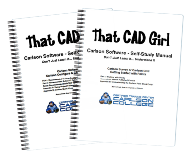
More than just tutorials, these training books cover particular topics in Carlson Software in great detail – so much so that prior knowledge of AutoCAD or IntelliCAD is not required. This is the next best thing to customized Carlson Software training and you can work at your own pace.

View a sample of the Getting Started With Points manual here


This is one book that contains two lessons…

Lesson 1: Carlson Configuration and Settings 

Approximately 0.5 hours of instruction

When first launching Carlson Software, you can make changes to the configuration and options that will apply to the current and future drawing sessions. Some of the settings and options are specific to Carlson Software and some are specific to AutoCAD® or IntelliCAD®.

Part 1 of this lesson contains Carlson Software‐specific settings and is applicable to anyone using Carlson with either an AutoCAD or IntelliCAD platform.

Part 2 contains AutoCAD‐specific settings.

Part 3 contains IntelliCAD‐specific settings.

Appendix A explains how to use the Project Folder method of Project/Data File Setup as an alternative to the Drawing Folder method.

Appendix B explains the use of Carlson Quick Keys and how they interact with AutoCAD and IntelliCAD command Aliases.


Lesson 2: Carlson Survey  Getting Started with Points

Approximately 4.5 hours of instruction

This lesson starts by loading a configuration file with recommended settings and options for the program. We will also open a few toolbars that may be needed for the exercises.

We will then start a new project and new drawing from a text/ascii file and will draw the points with the Draw‐Locate Points command. Various point editing and reporting commands and features will be used. Some of these features include: Point Groups, Tag Non‐Surface Points, Translate Points and Rotate Points. In wrapping up Part 1, we will export points to a new text/ascii file and also export the point data to a LandXML (.xml) file. Please note that Carlson’s Field to Finish is covered in a separate lesson.

Appendix A covers, as a separate exercise, the new Esri‐powered command Search Published Control that allows you to search published control data that is freely available on the National Geodetic Survey (NGS) website and then store the retrieved information to the active Coordinate File.

Appendix B provides a separate, in‐depth, explanation of the Carlson Point Block entity and how its Symbols and Point Attributes (Point Number, Elevation and Description) are controlled with respect to Layers.

The Fine Print
+
This is a physical shipment that will ship via UPS. Shipment includes printed manual(s) and a USB jump drive.

Please call for orders outside the United States. Will not accept overseas order through the store – call or email

Written when 2013 was current

All sales are final. Other Terms and Conditions of the sale can be found here.


Carlson Self-Study Training Manuals (Bundle)

What's Inside
+
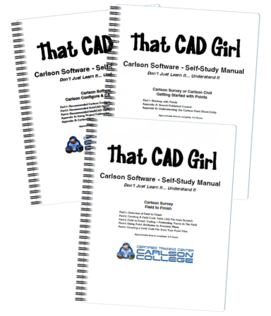
More than just tutorials, these training books cover particular topics in Carlson Software in great detail – so much so that prior knowledge of AutoCAD or IntelliCAD is not required. This is the next best thing to customized Carlson Software training and you can work at your own pace.

View a sample index here

View a sample of the Getting Started With Points manual here

View a sample of the Field to Finish manual here


Book 1 contains two lessons…

Lesson 1: Carlson Configuration and Settings

Approximately 0.5 hours of instruction

When first launching Carlson Software, you can make changes to the configuration and options that will apply to the current and future drawing sessions. Some of the settings and options are specific to Carlson Software and some are specific to AutoCAD®  training or IntelliCAD®.

Part 1 of this lesson contains Carlson Software‐specific settings and is applicable to anyone using Carlson with either an AutoCAD or IntelliCAD platform.

Part 2 contains AutoCAD‐specific settings.

Part 3 contains IntelliCAD‐specific settings.

Appendix A explains how to use the Project Folder method of Project/Data File Setup as an alternative to the Drawing Folder method.

Appendix B explains the use of Carlson Quick Keys and how they interact with AutoCAD and IntelliCAD command Aliases.


Lesson 2: Carlson Survey  Getting Started with Points

Approximately 4.5 hours of instruction

This lesson starts by loading a configuration file with recommended settings and options for the program. We will also open a few toolbars that may be needed for the exercises.

We will then start a new project and new drawing from a text/ascii file and will draw the points with the Draw‐Locate Points command. Various point editing and reporting commands and features will be used. Some of these features include: Point Groups, Tag Non‐Surface Points, Translate Points and Rotate Points. In wrapping up Part 1, we will export points to a new text/ascii file and also export the point data to a LandXML (.xml) file. Please note that Carlson’s Field to Finish is covered in a separate lesson.

Appendix A covers, as a separate exercise, the new Esri‐powered command Search Published Control that allows you to search published control data that is freely available on the National Geodetic Survey (NGS) website and then store the retrieved information to the active Coordinate File.

Appendix B provides a separate, in‐depth, explanation of the Carlson Point Block entity and how its Symbols and Point Attributes (Point Number, Elevation and Description) are controlled with respect to Layers.


Carlson Field to Finish

Approximately 6.5 hours of instruction

This lesson starts by loading a configuration file that contains recommended settings and options for the program. We will also open a few toolbars that may be needed for the exercises.

Part 1 provides an overview of the Field to Finish feature of Carlson® Survey. We will start a new project and new drawing from a text/ascii file. The text file is very similar to the one used in Lesson 2a – Getting Started with Points except that it has been slightly modified to include special linework coding. We will use Field to Finish so that the points, symbols and linework are automatically generated and drawn on their proper Layers. Field to Finish will also create Point Groups and tag some points as Non‐Surface so they can be easily excluded when we build a surface model.

In Part 2 we will create a new Field to Finish Code Table that includes a variety of Codes that can be used to create Symbols, 3d and 2d Linework.

In Part 3 we will simulate collecting more than 70 survey points in the field and then processing them with the Field to Finish Code Table created in Part 2. With this Code Table, we will collect points for features such as roadways, buildings, trees and property corners. We will also demonstrate the use of Special Codes for labeling descriptive information such as ½” Iron Pipe
and 12” Oak Tree.

In Part 4 we will use the Separate Attribute Layers functionality within Field to Finish so that Symbols and Descriptions for points we process can be used to label features on printed plans.

In Part 5 we will go through the steps required take some of your existing point files to make a new Field to Finish Code Table for your company.

The Fine Print
+
This is a physical shipment that will ship via UPS. Shipment includes printed manual(s) and a USB jump drive.

Please call for orders outside the United States. Will not accept overseas order through the store – call or email

Written when 2013 was current

All sales are final. Other Terms and Conditions of the sale can be found here.


Carlson Year End Special!
Carlson Photo Capture Standalone with Point Cloud Advanced

Relevant FAQs
+
Delivery, Downloads and 30 Day Trials
+
Delivery & Downloads

All Carlson Software purchases will be fulfilled electronically by a download link that will be emailed to you (along with your new serial number) within two business days of your order being processed. The download link and serial number can be used to install and register your software immediately.

For delivery to addresses within the United States, we can also ship you a flash drive via UPS Ground for an additional charge. Please note that the physical shipment DOES NOT include manuals.

Your box shipment will arrive approximately 14 business days after your order has been processed. Be aware that software purchases outside the United States will be fulfilled by download only. If you pay the extra charge for the physical shipment we will only provide a download link and will then refund the shipping charge.

30 Day Trials

Click here to request a 30 day trial serial number

Need more pricing options?
+
Need pricing for upgrades, maintenance renewals or for orders of 4 or more licenses?

Click here to send us a message or click here to Request a Custom Proposal to see what we can do!
Terms and Conditions for All Sales
+


Carlson Year End Special!
Upgrade Point Cloud Basic to Advanced

Relevant FAQs
+
Delivery, Downloads and 30 Day Trials
+
Delivery & Downloads

All Carlson Software purchases will be fulfilled electronically by a download link that will be emailed to you (along with your new serial number) within two business days of your order being processed. The download link and serial number can be used to install and register your software immediately.

For delivery to addresses within the United States, we can also ship you a flash drive via UPS Ground for an additional charge. Please note that the physical shipment DOES NOT include manuals.

Your box shipment will arrive approximately 14 business days after your order has been processed. Be aware that software purchases outside the United States will be fulfilled by download only. If you pay the extra charge for the physical shipment we will only provide a download link and will then refund the shipping charge.

30 Day Trials

Click here to request a 30 day trial serial number

Need more pricing options?
+
Need pricing for upgrades, maintenance renewals or for orders of 4 or more licenses?

Click here to send us a message or click here to Request a Custom Proposal to see what we can do!
Terms and Conditions for All Sales
+


Carlson Civil

New to Carlson? Learn More Here
+
The Carlson Software modules for land development professionals provide very competitive alternatives to Autodesk‘s Civil 3D, Land Desktop (retired), Civil Design (retired), Raster Design (retired), Paydirt (retired), Quest Construction and Agtek software programs.

Carlson’s desktop software must be installed with a CAD platform such as IntelliCAD, AutoCAD or embedded AutoCAD (OEM). Carlson Software includes a perpetual license of IntelliCAD with their “For CAD” modules but also allows users to install the program on top of your own separately purchased license of a full AutoCAD-based program such as AutoCAD, Map or Civil 3D.

Carlson Survey and Carlson Takeoff are the only 2 programs that can be purchased with an embedded AutoCAD (OEM) license.

ALL Carlson desktop products work natively in the latest DWG format. This means that you create DWG files, you open DWG files and you save DWG files – there is no need to import, export or convert to others using a different CAD-based program.

Your purchase of Carlson includes a perpetual license of the Carlson program and either IntelliCAD or embedded AutoCAD (OEM).

Carlson Software can be purchased as individual modules or by bundling 2 or more products at a discounted price so you only pay for what you need!

Carlson Civil Suite includes the Survey, Civil, Hydrology and GIS modules and compares to Autodesk Civil 3D.

Carlson CADnet is a single module that’s functionality is comparable to Autodesk Raster Design.

You can also use a Select Suite to build your own bundle of a Pick 2, Pick 3, Pick 4, Pick 5 or Pick 6 choosing from Survey, Civil, Hydrology, GIS, CADnet and Point Cloud Basic.

Carlson Takeoff Suite and Takeoff with embedded AutoCAD (OEM) is comparable to Paydirt (retired), Quest Construction and Agtek software programs.

All Carlson desktop software products provide a wide range of conversion and import and export functions for other file formats such as Civil 3d, LandXML, Topcon and Trimble.

For Carlson products that run with IntellliCAD and/or your separately purchased license of AutoCAD, Carlson offers users an Annual Maintenance program that keeps the software up to date. The purchase of Maintenance is optional and pricing is calculated at 10% of the retail price of the product per year.

Carlson Software offers free technical support from their main office to all Carlson Software users regardless of customer or license status.

Although users may find it difficult to install older Carlson desktop software on newer machines due to limitations of newer Windows operating systems, Carlson continues offering support for those versions.

More About Carlson Civil
+
Carlson Civil extends beyond the capabilities of the CAD platform it operates on, offering dynamic design tools tailored for site, subdivision, and roadway engineers.

Comparable to industry-standard engineering design software, Carlson Civil provides features for layer-based quantity takeoffs, 3D modeling, and construction estimating, including specialized commands like SiteNet for streamlined volume and material quantity calculations.


In addition to the functionality of the CAD-platform it’s running on top of and the identical commands available in the first 7 menus of all Carlson Desktop Software, Carlson Civil offers dynamic design and plan production for site, subdivision and roadway design engineers.

The commands and features in Carlson Civil are comparable to the engineering design components of programs such as: DCA/Softdesk/Land Desktop (retired), AutoCAD Map, Civil 3D, Eagle Point (retired), TerraModel (retired), GeoPak and InRoads.

Carlson Civil also provides users with the tools needed for layer-based quantity takeoffs and model building in the 3D Data and SiteNet menus. The commands in SiteNet are comparable to construction estimating software such as Paydirt, Quest and Agtek.

With Carlson Civil, users are able to:

  • import and export data files for Civil 3d, Land Desktop, LandXML, Trimble, Topcon, Google Earth and more
  • create and manage points in the drawing or in the CRD file editor
  • use a variety of specialized commands to convert 2D linework to 3D using points, text with leaders, surface files, drawing entities and more
  • use SiteNet, a layer-based feature that simplifies the process of estimating dirt and topsoil volumes and quantities of other materials such as subgrade volumes, length of curb and number of trees or other structures to be built or demolished
  • create and manage surface model triangulation files from field data or importing from Google Earth or other sources
  • view and perform quality checks on surface model files in various 3d viewers including a 3D Fly By
  • calculate earthwork volumes for pads, stockpiles or between two surfaces and calculate adjustments required to balance cut and fill
  • create cut/fill labels and color maps
  • create and manage horizontal alignments
  • create and manage profiles of ground elevations, roadways, sewer pipes and crossings
  • design ditches and trenches
  • calculate and report quantities and depths of pipe installation projects
  • create and manage cross-sections
  • dynamically design a network of roads with intersections and cul-de-sacs that automatically adjust and provide dynamic, real-time cut and fill volumes
  • design and map single parcel boundaries or networks of subdivision lots that dynamically adjust to accommodate building footprint and setback restrictions.

Relevant FAQs from That CAD Girl
+
Delivery, Downloads and 30 Day Trials
+
Delivery & Downloads

All Carlson Software purchases will be fulfilled electronically by a download link that will be emailed to you (along with your new serial number) within two business days of your order being processed. The download link and serial number can be used to install and register your software immediately.

For delivery to addresses within the United States, we can also ship you a flash drive via UPS Ground for an additional charge. Please note that the physical shipment DOES NOT include manuals.

Your box shipment will arrive approximately 14 business days after your order has been processed. Be aware that software purchases outside the United States will be fulfilled by download only. If you pay the extra charge for the physical shipment we will only provide a download link and will then refund the shipping charge.

30 Day Trials

Click here to request a 30 day trial serial number

Need more pricing options?
+
Need pricing for upgrades, maintenance renewals or for orders of 4 or more licenses?

Click here to send us a message or click here to Request a Custom Proposal to see what we can do!
Terms and Conditions for All Sales
+


Carlson GIS

New to Carlson? Learn More Here
+
The Carlson Software modules for land development professionals provide very competitive alternatives to Autodesk‘s Civil 3D, Land Desktop (retired), Civil Design (retired), Raster Design (retired), Paydirt (retired), Quest Construction and Agtek software programs.

Carlson’s desktop software must be installed with a CAD platform such as IntelliCAD, AutoCAD or embedded AutoCAD (OEM). Carlson Software includes a perpetual license of IntelliCAD with their “For CAD” modules but also allows users to install the program on top of your own separately purchased license of a full AutoCAD-based program such as AutoCAD, Map or Civil 3D.

Carlson Survey and Carlson Takeoff are the only 2 programs that can be purchased with an embedded AutoCAD (OEM) license.

ALL Carlson desktop products work natively in the latest DWG format. This means that you create DWG files, you open DWG files and you save DWG files – there is no need to import, export or convert to others using a different CAD-based program.

Your purchase of Carlson includes a perpetual license of the Carlson program and either IntelliCAD or embedded AutoCAD (OEM).

Carlson Software can be purchased as individual modules or by bundling 2 or more products at a discounted price so you only pay for what you need!

Carlson Civil Suite includes the Survey, Civil, Hydrology and GIS modules and compares to Autodesk Civil 3D.

Carlson CADnet is a single module that’s functionality is comparable to Autodesk Raster Design.

You can also use a Select Suite to build your own bundle of a Pick 2, Pick 3, Pick 4, Pick 5 or Pick 6 choosing from Survey, Civil, Hydrology, GIS, CADnet and Point Cloud Basic.

Carlson Takeoff Suite and Takeoff with embedded AutoCAD (OEM) is comparable to Paydirt (retired), Quest Construction and Agtek software programs.

All Carlson desktop software products provide a wide range of conversion and import and export functions for other file formats such as Civil 3d, LandXML, Topcon and Trimble.

For Carlson products that run with IntellliCAD and/or your separately purchased license of AutoCAD, Carlson offers users an Annual Maintenance program that keeps the software up to date. The purchase of Maintenance is optional and pricing is calculated at 10% of the retail price of the product per year.

Carlson Software offers free technical support from their main office to all Carlson Software users regardless of customer or license status.

Although users may find it difficult to install older Carlson desktop software on newer machines due to limitations of newer Windows operating systems, Carlson continues offering support for those versions.

More About Carlson GIS
+
Carlson GIS offers a comprehensive set of tools for managing Geographic Information Systems, supporting both importing from Esri Shapefiles and creating GIS entities within DWG files. GIS gives users the ability to insert and convert geo-referenced images from sources like Esri and Google Earth, and includes features for data capture, labeling, import/export of SHP files, and polygon topology analysis.

Carlson calls this program “An awesome GIS “Swiss Army Knife” for the surveyor or engineer.”


Carlson GIS includes many tools for managing a Geographic Information System whether importing from Esri Shapefiles or creating one from scratch using entities in your DWG file.

Carlson GIS also provides tools for inserting and converting geo-referenced images from outside sources such as Esri, Google Earth and MrSID.

Relevant FAQs from That CAD Girl
+
Delivery, Downloads and 30 Day Trials
+
Delivery & Downloads

All Carlson Software purchases will be fulfilled electronically by a download link that will be emailed to you (along with your new serial number) within two business days of your order being processed. The download link and serial number can be used to install and register your software immediately.

For delivery to addresses within the United States, we can also ship you a flash drive via UPS Ground for an additional charge. Please note that the physical shipment DOES NOT include manuals.

Your box shipment will arrive approximately 14 business days after your order has been processed. Be aware that software purchases outside the United States will be fulfilled by download only. If you pay the extra charge for the physical shipment we will only provide a download link and will then refund the shipping charge.

30 Day Trials

Click here to request a 30 day trial serial number

Need more pricing options?
+
Need pricing for upgrades, maintenance renewals or for orders of 4 or more licenses?

Click here to send us a message or click here to Request a Custom Proposal to see what we can do!
Terms and Conditions for All Sales
+


Carlson Hydrology

New to Carlson? Learn More Here
+
The Carlson Software modules for land development professionals provide very competitive alternatives to Autodesk‘s Civil 3D, Land Desktop (retired), Civil Design (retired), Raster Design (retired), Paydirt (retired), Quest Construction and Agtek software programs.

Carlson’s desktop software must be installed with a CAD platform such as IntelliCAD, AutoCAD or embedded AutoCAD (OEM). Carlson Software includes a perpetual license of IntelliCAD with their “For CAD” modules but also allows users to install the program on top of your own separately purchased license of a full AutoCAD-based program such as AutoCAD, Map or Civil 3D.

Carlson Survey and Carlson Takeoff are the only 2 programs that can be purchased with an embedded AutoCAD (OEM) license.

ALL Carlson desktop products work natively in the latest DWG format. This means that you create DWG files, you open DWG files and you save DWG files – there is no need to import, export or convert to others using a different CAD-based program.

Your purchase of Carlson includes a perpetual license of the Carlson program and either IntelliCAD or embedded AutoCAD (OEM).

Carlson Software can be purchased as individual modules or by bundling 2 or more products at a discounted price so you only pay for what you need!

Carlson Civil Suite includes the Survey, Civil, Hydrology and GIS modules and compares to Autodesk Civil 3D.

Carlson CADnet is a single module that’s functionality is comparable to Autodesk Raster Design.

You can also use a Select Suite to build your own bundle of a Pick 2, Pick 3, Pick 4, Pick 5 or Pick 6 choosing from Survey, Civil, Hydrology, GIS, CADnet and Point Cloud Basic.

Carlson Takeoff Suite and Takeoff with embedded AutoCAD (OEM) is comparable to Paydirt (retired), Quest Construction and Agtek software programs.

All Carlson desktop software products provide a wide range of conversion and import and export functions for other file formats such as Civil 3d, LandXML, Topcon and Trimble.

For Carlson products that run with IntellliCAD and/or your separately purchased license of AutoCAD, Carlson offers users an Annual Maintenance program that keeps the software up to date. The purchase of Maintenance is optional and pricing is calculated at 10% of the retail price of the product per year.

Carlson Software offers free technical support from their main office to all Carlson Software users regardless of customer or license status.

Although users may find it difficult to install older Carlson desktop software on newer machines due to limitations of newer Windows operating systems, Carlson continues offering support for those versions.

More About Carlson Hydrology
+
Carlson Hydrology offers engineers and hydrologists a user-friendly hydrologic and hydraulic solution seamlessly integrated into CAD environments, allowing for easy navigation and utilization of common elements like polylines and text.

With its comprehensive suite of features, Carlson Hydrology streamlines site drainage and runoff analysis, storm drain system design and drafting, and precise pond design and sizing, providing a robust toolset for water management projects.


Carlson Hydrology is a complete hydrologic and hydraulic solution for engineers and hydrologists.

Carlson Hydrology offers a user-friendly interface within the familiar CAD environment, making it effortless to navigate with common elements like polylines, text, and layers.

Carlson Hydrology facilitates thorough site drainage and runoff analysis, including storm drain system design and drafting as well as precise pond design and sizing capabilities.

Relevant FAQs from That CAD Girl
+
Delivery, Downloads and 30 Day Trials
+
Delivery & Downloads

All Carlson Software purchases will be fulfilled electronically by a download link that will be emailed to you (along with your new serial number) within two business days of your order being processed. The download link and serial number can be used to install and register your software immediately.

For delivery to addresses within the United States, we can also ship you a flash drive via UPS Ground for an additional charge. Please note that the physical shipment DOES NOT include manuals.

Your box shipment will arrive approximately 14 business days after your order has been processed. Be aware that software purchases outside the United States will be fulfilled by download only. If you pay the extra charge for the physical shipment we will only provide a download link and will then refund the shipping charge.

30 Day Trials

Click here to request a 30 day trial serial number

Need more pricing options?
+
Need pricing for upgrades, maintenance renewals or for orders of 4 or more licenses?

Click here to send us a message or click here to Request a Custom Proposal to see what we can do!
Terms and Conditions for All Sales
+


Carlson Point Cloud Advanced

New to Carlson? Learn More Here
+
The Carlson Software modules for land development professionals provide very competitive alternatives to Autodesk‘s Civil 3D, Land Desktop (retired), Civil Design (retired), Raster Design (retired), Paydirt (retired), Quest Construction and Agtek software programs.

Carlson’s desktop software must be installed with a CAD platform such as IntelliCAD, AutoCAD or embedded AutoCAD (OEM). Carlson Software includes a perpetual license of IntelliCAD with their “For CAD” modules but also allows users to install the program on top of your own separately purchased license of a full AutoCAD-based program such as AutoCAD, Map or Civil 3D.

Carlson Survey and Carlson Takeoff are the only 2 programs that can be purchased with an embedded AutoCAD (OEM) license.

ALL Carlson desktop products work natively in the latest DWG format. This means that you create DWG files, you open DWG files and you save DWG files – there is no need to import, export or convert to others using a different CAD-based program.

Your purchase of Carlson includes a perpetual license of the Carlson program and either IntelliCAD or embedded AutoCAD (OEM).

Carlson Software can be purchased as individual modules or by bundling 2 or more products at a discounted price so you only pay for what you need!

Carlson Civil Suite includes the Survey, Civil, Hydrology and GIS modules and compares to Autodesk Civil 3D.

Carlson CADnet is a single module that’s functionality is comparable to Autodesk Raster Design.

You can also use a Select Suite to build your own bundle of a Pick 2, Pick 3, Pick 4, Pick 5 or Pick 6 choosing from Survey, Civil, Hydrology, GIS, CADnet and Point Cloud Basic.

Carlson Takeoff Suite and Takeoff with embedded AutoCAD (OEM) is comparable to Paydirt (retired), Quest Construction and Agtek software programs.

All Carlson desktop software products provide a wide range of conversion and import and export functions for other file formats such as Civil 3d, LandXML, Topcon and Trimble.

For Carlson products that run with IntellliCAD and/or your separately purchased license of AutoCAD, Carlson offers users an Annual Maintenance program that keeps the software up to date. The purchase of Maintenance is optional and pricing is calculated at 10% of the retail price of the product per year.

Carlson Software offers free technical support from their main office to all Carlson Software users regardless of customer or license status.

Although users may find it difficult to install older Carlson desktop software on newer machines due to limitations of newer Windows operating systems, Carlson continues offering support for those versions.

More About Carlson Point Cloud
+
Carlson Point Cloud allows users to efficiently register scans to local coordinates, automate field-to-finish processing of linework and symbols, and generate contours, profiles, sections, and breaklines directly from point cloud data.

This innovative software seamlessly integrates with Carlson Survey, Carlson Civil, and Carlson Mining programs, empowering users to handle extensive datasets of up to 1 billion points and produce CAD deliverables effortlessly within the familiar Carlson environment.


Carlson Point Cloud can be purchased with either Advanced or Basic feature offerings. Both programs are able to go from field scan to finished plat, all with seamless integration to Carlson Survey, Carlson Civil and Carlson Mining programs.

This innovative software empowers users with robust automation capabilities, effortlessly handling extensive datasets of up to 1 billion points while maintaining the intuitive Carlson interface.

With Carlson Point Cloud, users can:

  • register scans to local coordinates, refine point sets through filtering or decimation, and incorporate raster images into 3D environments
  • utilize edge snapping and code descriptions for automated field-to-finish processing of linework and symbols
  • generate contours, profiles, sections, and breaklines directly from the point cloud data
  • export comprehensive surface models, points, contours, breaklines, grids, and profiles directly to DWG files.

Relevant FAQs from That CAD Girl
+
Delivery, Downloads and 30 Day Trials
+
Delivery & Downloads

All Carlson Software purchases will be fulfilled electronically by a download link that will be emailed to you (along with your new serial number) within two business days of your order being processed. The download link and serial number can be used to install and register your software immediately.

For delivery to addresses within the United States, we can also ship you a flash drive via UPS Ground for an additional charge. Please note that the physical shipment DOES NOT include manuals.

Your box shipment will arrive approximately 14 business days after your order has been processed. Be aware that software purchases outside the United States will be fulfilled by download only. If you pay the extra charge for the physical shipment we will only provide a download link and will then refund the shipping charge.

30 Day Trials

Click here to request a 30 day trial serial number

Need more pricing options?
+
Need pricing for upgrades, maintenance renewals or for orders of 4 or more licenses?

Click here to send us a message or click here to Request a Custom Proposal to see what we can do!
Terms and Conditions for All Sales
+


Carlson Point Cloud Basic

New to Carlson? Learn More Here
+
The Carlson Software modules for land development professionals provide very competitive alternatives to Autodesk‘s Civil 3D, Land Desktop (retired), Civil Design (retired), Raster Design (retired), Paydirt (retired), Quest Construction and Agtek software programs.

Carlson’s desktop software must be installed with a CAD platform such as IntelliCAD, AutoCAD or embedded AutoCAD (OEM). Carlson Software includes a perpetual license of IntelliCAD with their “For CAD” modules but also allows users to install the program on top of your own separately purchased license of a full AutoCAD-based program such as AutoCAD, Map or Civil 3D.

Carlson Survey and Carlson Takeoff are the only 2 programs that can be purchased with an embedded AutoCAD (OEM) license.

ALL Carlson desktop products work natively in the latest DWG format. This means that you create DWG files, you open DWG files and you save DWG files – there is no need to import, export or convert to others using a different CAD-based program.

Your purchase of Carlson includes a perpetual license of the Carlson program and either IntelliCAD or embedded AutoCAD (OEM).

Carlson Software can be purchased as individual modules or by bundling 2 or more products at a discounted price so you only pay for what you need!

Carlson Civil Suite includes the Survey, Civil, Hydrology and GIS modules and compares to Autodesk Civil 3D.

Carlson CADnet is a single module that’s functionality is comparable to Autodesk Raster Design.

You can also use a Select Suite to build your own bundle of a Pick 2, Pick 3, Pick 4, Pick 5 or Pick 6 choosing from Survey, Civil, Hydrology, GIS, CADnet and Point Cloud Basic.

Carlson Takeoff Suite and Takeoff with embedded AutoCAD (OEM) is comparable to Paydirt (retired), Quest Construction and Agtek software programs.

All Carlson desktop software products provide a wide range of conversion and import and export functions for other file formats such as Civil 3d, LandXML, Topcon and Trimble.

For Carlson products that run with IntellliCAD and/or your separately purchased license of AutoCAD, Carlson offers users an Annual Maintenance program that keeps the software up to date. The purchase of Maintenance is optional and pricing is calculated at 10% of the retail price of the product per year.

Carlson Software offers free technical support from their main office to all Carlson Software users regardless of customer or license status.

Although users may find it difficult to install older Carlson desktop software on newer machines due to limitations of newer Windows operating systems, Carlson continues offering support for those versions.

More About Carlson Point Cloud
+
Carlson Point Cloud allows users to efficiently register scans to local coordinates, automate field-to-finish processing of linework and symbols, and generate contours, profiles, sections, and breaklines directly from point cloud data.

This innovative software seamlessly integrates with Carlson Survey, Carlson Civil, and Carlson Mining programs, empowering users to handle extensive datasets of up to 1 billion points and produce CAD deliverables effortlessly within the familiar Carlson environment.


Carlson Point Cloud can be purchased with either Basic or Advanced feature offerings. Both programs are able to go from field scan to finished plat, all with seamless integration to Carlson Survey, Carlson Civil and Carlson Mining programs.

This innovative software empowers users with robust automation capabilities, effortlessly handling extensive datasets of up to 1 billion points while maintaining the intuitive Carlson interface.

With Carlson Point Cloud, users can:

  • register scans to local coordinates, refine point sets through filtering or decimation, and incorporate raster images into 3D environments
  • utilize edge snapping and code descriptions for automated field-to-finish processing of linework and symbols
  • generate contours, profiles, sections, and breaklines directly from the point cloud data
  • export comprehensive surface models, points, contours, breaklines, grids, and profiles directly to DWG files.

Relevant FAQs from That CAD Girl
+
Delivery, Downloads and 30 Day Trials
+
Delivery & Downloads

All Carlson Software purchases will be fulfilled electronically by a download link that will be emailed to you (along with your new serial number) within two business days of your order being processed. The download link and serial number can be used to install and register your software immediately.

For delivery to addresses within the United States, we can also ship you a flash drive via UPS Ground for an additional charge. Please note that the physical shipment DOES NOT include manuals.

Your box shipment will arrive approximately 14 business days after your order has been processed. Be aware that software purchases outside the United States will be fulfilled by download only. If you pay the extra charge for the physical shipment we will only provide a download link and will then refund the shipping charge.

30 Day Trials

Click here to request a 30 day trial serial number

Need more pricing options?
+
Need pricing for upgrades, maintenance renewals or for orders of 4 or more licenses?

Click here to send us a message or click here to Request a Custom Proposal to see what we can do!

Terms and Conditions for All Sales
+


Carlson Survey
with embedded AutoCAD (OEM)

New to Carlson? Learn More Here
+
The Carlson Software modules for land development professionals provide very competitive alternatives to Autodesk‘s Civil 3D, Land Desktop (retired), Civil Design (retired), Raster Design (retired), Paydirt (retired), Quest Construction and Agtek software programs.

Carlson’s desktop software must be installed with a CAD platform such as IntelliCAD, AutoCAD or embedded AutoCAD (OEM). Carlson Software includes a perpetual license of IntelliCAD with their “For CAD” modules but also allows users to install the program on top of your own separately purchased license of a full AutoCAD-based program such as AutoCAD, Map or Civil 3D.

Carlson Survey and Carlson Takeoff are the only 2 programs that can be purchased with an embedded AutoCAD (OEM) license.

ALL Carlson desktop products work natively in the latest DWG format. This means that you create DWG files, you open DWG files and you save DWG files – there is no need to import, export or convert to others using a different CAD-based program.

Your purchase of Carlson includes a perpetual license of the Carlson program and either IntelliCAD or embedded AutoCAD (OEM).

Carlson Software can be purchased as individual modules or by bundling 2 or more products at a discounted price so you only pay for what you need!

Carlson Civil Suite includes the Survey, Civil, Hydrology and GIS modules and compares to Autodesk Civil 3D.

Carlson CADnet is a single module that’s functionality is comparable to Autodesk Raster Design.

You can also use a Select Suite to build your own bundle of a Pick 2, Pick 3, Pick 4, Pick 5 or Pick 6 choosing from Survey, Civil, Hydrology, GIS, CADnet and Point Cloud Basic.

Carlson Takeoff Suite and Takeoff with embedded AutoCAD (OEM) is comparable to Paydirt (retired), Quest Construction and Agtek software programs.

All Carlson desktop software products provide a wide range of conversion and import and export functions for other file formats such as Civil 3d, LandXML, Topcon and Trimble.

For Carlson products that run with IntellliCAD and/or your separately purchased license of AutoCAD, Carlson offers users an Annual Maintenance program that keeps the software up to date. The purchase of Maintenance is optional and pricing is calculated at 10% of the retail price of the product per year.

Carlson Software offers free technical support from their main office to all Carlson Software users regardless of customer or license status.

Although users may find it difficult to install older Carlson desktop software on newer machines due to limitations of newer Windows operating systems, Carlson continues offering support for those versions.

More About Carlson Survey
+
Carlson Survey encompasses a wide array of features comparable to survey and GIS components found in various software programs, including retired ones like DCA/Softdesk/Land Desktop and Eagle Point.

It offers comprehensive desktop drafting, calculation, and mapping capabilities essential for land surveyors, alongside seamless integration with field data collection software like SurvPC and SurvCE.


Carlson Survey includes features that are comparable to the survey and GIS components of programs such as: DCA/Softdesk/Land Desktop (retired), AutoCAD Map, Civil 3d, Eagle Point (retired), TerraModel (retired), GeoPak and InRoads.

Carlson Survey also includes all the menus and functionality of the retired C & G Software program.

In addition to the functionality of the CAD-platform it’s running on top of and the identical functionality available in the first 7 menus of all Carlson Desktop Software, Carlson Survey offers all the desktop drafting, calculation and mapping abilities a land surveyor needs.

Additionally, the drawing and data files such as Coordinate (CRD) and Field Codes (FLD and FCL) can be shared and used directly by Carlson’s field data collection software SurvPC and (retired) SurvCE.

With Carlson Survey, users are able to:

  • import and export data files for Civil 3d, Land Desktop, LandXML, Trimble, Topcon, Google Earth and more
  • import and adjust raw data files using various methods including least squares analysis, Compass , Crandall and Transit
  • perform all COGO-related queries and staking calculations
  • perform survey-related tasks such as translations, map and deed checks and closures, point setting and staking, blunder detection, legal description writer and deed correlation
  • perform a limited scope of GIS-related tasks that include importing and exporting shapefiles and importing MrSID or other geo-referenced imagery and feature data
  • create and manage points in the drawing or in the CRD file editor
  • use Field to Finish to draw points, symbols and both 2D and 3D linework for plan production and model building
  • create and manage surface model triangulation files from field data or importing from Google Earth or other sources
  • calculate earthwork volumes for pads, stockpiles or between two surfaces and calculate adjustments required to balance cut and fill
  • view and perform quality checks on surface model files in various 3d viewers including a 3D Fly By
  • create and manage horizontal alignments
  • create and manage profiles of ground elevations, roadways, sewer pipes and crossings
  • design and map single parcel boundaries or networks of subdivision lots that dynamically adjust to accommodate building footprint and setback restrictions.

Relevant FAQs from That CAD Girl
+
Delivery, Downloads and 30 Day Trials
+
Delivery & Downloads

All Carlson Software purchases will be fulfilled electronically by a download link that will be emailed to you (along with your new serial number) within two business days of your order being processed. The download link and serial number can be used to install and register your software immediately.

For delivery to addresses within the United States, we can also ship you a flash drive via UPS Ground for an additional charge. Please note that the physical shipment DOES NOT include manuals.

Your box shipment will arrive approximately 14 business days after your order has been processed. Be aware that software purchases outside the United States will be fulfilled by download only. If you pay the extra charge for the physical shipment we will only provide a download link and will then refund the shipping charge.

30 Day Trials

Click here to request a 30 day trial serial number

Need more pricing options?
+
Need pricing for upgrades, maintenance renewals or for orders of 4 or more licenses?

Click here to send us a message or click here to Request a Custom Proposal to see what we can do!

Terms and Conditions for All Sales
+